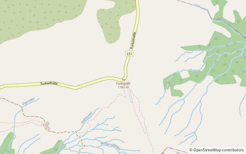
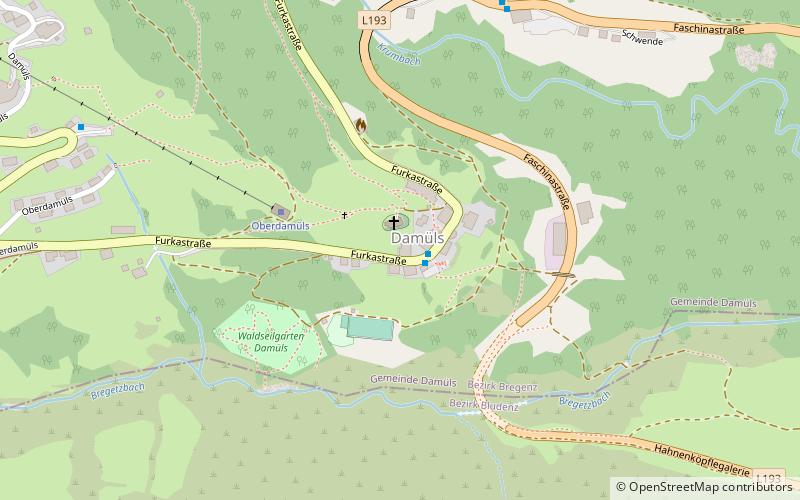
Furkajoch
#637 among destinations in Austria

Facts and practical information
VorarlbergAustria
Furkajoch plan & book
Unleash the traveler in you — discover the cheapest flight deals, find the perfect hotel or hostel nearby, and search for the best car rental prices. Travel at your own pace to discover new places and enjoy your journey.
Furkajoch – popular in the area (distance from the attraction)
Nearby attractions include: Kanisfluh, Damülser Mittagsspitze, Bregenz Forest Mountains, Damüls-Mellau.
 Scenic peaks with trails and summit views
Kanisfluh
162 min walk • Kanisfluh is an imposing mountain located in the Bregenzerwald range in Vorarlberg, Austria, known for its distinctive, rugged profile that dominates the surrounding landscape. This majestic peak rises to an elevation of 2,044 meters and is a prominent feature in the...
 Nature, Natural attraction, Mountain
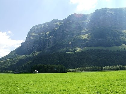
Damülser Mittagsspitze
99 min walk • Damülser Mittagsspitze is a 2,095 m high mountain in the Bregenz Forest Mountains in the Austrian state Vorarlberg. The normal route starts from the upper station of a chairlift at 1810 m and is UIAA grade I.
 Nature, Natural attraction, Mountain
Bregenz Forest Mountains
57 min walk • The Bregenz Forest Mountains, also the Bregenzerwald Mountains, are a range of the Northern Limestone Alps, named after the town of Bregenz. The Bregenz Forest Mountains are located entirely in the Austrian state of Vorarlberg.
 Winter sport, Ski area
Damüls-Mellau, Damüls
74 min walk • Damüls-Mellau is a ski area in Vorarlberg, Austria. It is most popular for its snow safety. In 2006, Damüls was awarded the honorary title 'snowiest village of the world'.
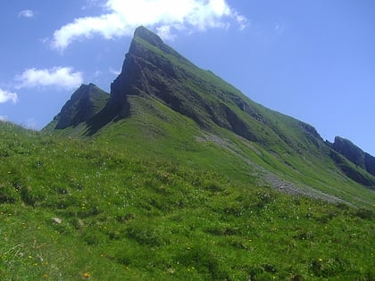
 Nature, Natural attraction, Mountain
Glatthorn
64 min walk • The Glatthorn in Vorarlberg in Austria is the highest mountain in the Bregenz Forest Mountains with a height of 2,133 m. It lies west of and above the saddle of Faschinajoch, between Damüls to the north and Fontanella in the Großwalsertal to the south.
 Nature, Natural attraction, Valley
Großwalsertal
135 min walk • The Großes Walsertal is located in the Austrian state of Vorarlberg. It is a side valley of the Walgau and stretches from there north to the mountainous center of the country. The end of the valley borders on the Bregenz Forest.
 Church
Pfarrkirche Heiliger Antonius Abt
158 min walk • The Parish Church of Düns is a Roman Catholic church in the municipality of Düns in Vorarlberg, Austria.
 Nature, Natural attraction, Mountain
Hoher Freschen
97 min walk • Hoher Freschen - a peak in the Bregen Forest, Eastern Alps band. It lies in Austria, in the union country of Vorarlberg.
 Nature, Natural attraction, Mountain
Hohe Kugel
185 min walk • The Hohe Kugel is a 1645 m above sea level mountain in the far west of the Bregenzerwald Mountains at the edge of the Rhine Valley. The summit of the mountain, which is popular as a hiking destination, is located in the municipal area of Fraxern.
 Nature, Natural attraction, Mountain
Hoher Fraßen
132 min walk • The Hohe Fraßen is a mountain 1979 m above sea level in the Lechquellen Mountains in the Austrian state of Vorarlberg. It is the westernmost independent mountain of the range.
 Nature, Natural attraction, Mountain
Mörzelspitze
142 min walk • The Mörzelspitze is a 1,830-meter-high mountain in the Bregenzerwald Mountains, located on the municipal border between the two Austrian municipalities of Dornbirn and Mellau in the Bregenzerwald.


