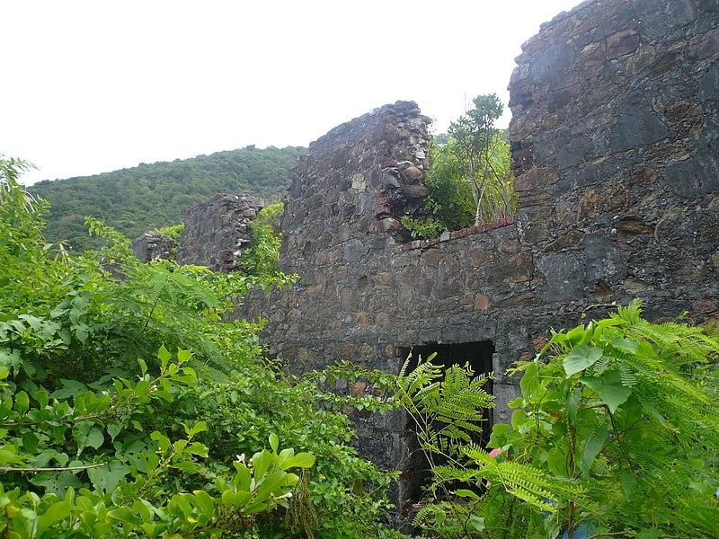
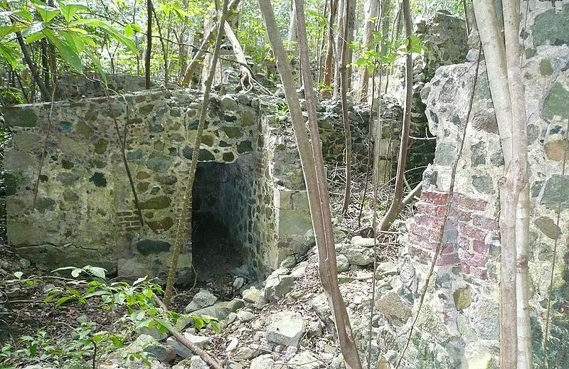
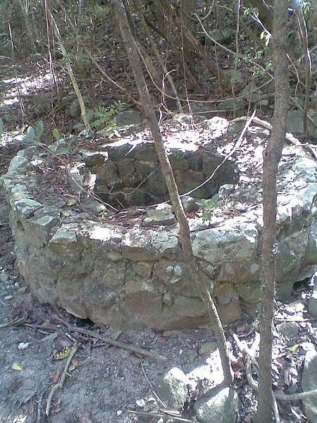
Cooper Bay ruin, Tortola
#4 among attractions in Tortola
Facts and practical information
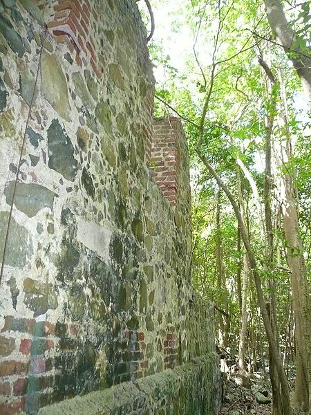
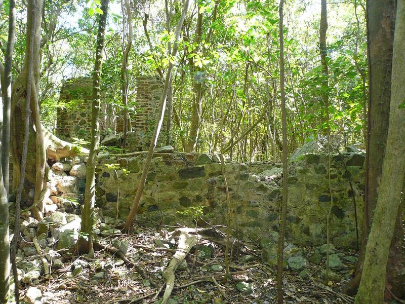
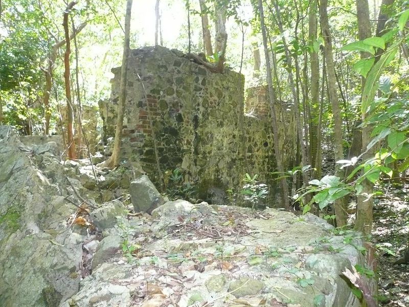
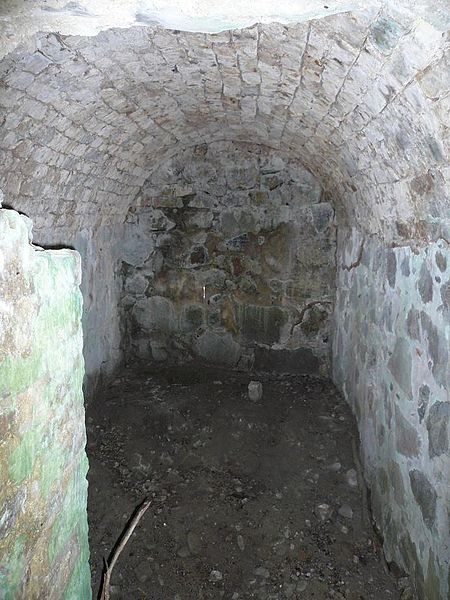
Cooper Bay ruin is a ruin in Cooper Bay, on the north side of Tortola in the British Virgin Islands. The ruin dates from the sugar plantation era, and was presumed abandoned during the economic collapse of the British Virgin Islands during the mid-19th century. ()
Tortola British Virgin Islands
Tortola plan & book
Unleash the traveler in you — discover the cheapest flight deals, find the perfect hotel or hostel nearby, and search for the best car rental prices. Travel at your own pace to discover new places and enjoy your journey.
Cooper Bay ruin – popular in the area (distance from the attraction)
Nearby attractions include: St. William's Church, Mount Sage National Park, The Moorings Marina, Fort Recovery.
- 1.9 miSChurch
St. William's Church, Road Town
48 min walk • The St. William's Church also alternatively called Catholic Church of St. William is a religious building that is affiliated with the Catholic Church and is located on the island of Tortola in the Main Street of the village of Road Town capital of the British Virgin Islands, a territory of the United Kingdom in the Lesser Antilles.
- 4 miSWNatural attraction, National park, Park
Mount Sage National Park, Tortola
102 min walk • Mount Sage National Park is a protected area of the British Virgin Islands. It is named after the highest peak of the island of Tortola, Mount Sage.
- 1.5 miS18°25'36"N • 64°36'56"W
The Moorings Marina, Road Town
39 min walk • Sailing, Scuba and snorkeling, Boat tours
- 5.8 miSWTower
Fort Recovery, Tortola
148 min walk • Fort Recovery is a fort on the West End of Tortola in the British Virgin Islands. In historical records, the fort is often referred to as Tower Fort, and the area around the fort is still referred to as "Towers" today. A hotel is now built around the Tower.
- 2.5 miSRuins
Fort Charlotte, Tortola
63 min walk • Fort Charlotte is a fort built on Harrigan's Hill, Tortola, British Virgin Islands. The fort was named after Charlotte of Mecklenburg-Strelitz, who was the wife of King George III.
- 1.7 miSERuins
Fort George, Road Town
44 min walk • Fort George is a colonial fort which was erected on the northeast edge of Road Town, Tortola in the British Virgin Islands above Baugher's Bay. The site is now a ruin.
- 4.4 miSWRuins
Fort Purcell, Tortola
113 min walk • Fort Purcell is a ruined fort near Pockwood Pond on the island of Tortola in the British Virgin Islands.
- 4.2 miEBridge
Queen Elizabeth II Bridge
106 min walk • The Queen Elizabeth II Bridge, sometimes called the Beef Island Bridge, is a bridge, 70 meters long, that links Beef Island with Tortola in the British Virgin Islands. The original bridge was opened in 1966, and was replaced by a new bridge in 2003.
- 1.3 miERuins
Cooten Bay ruin, Tortola
33 min walk • The Cooten Bay ruin is a ruin in Cooten Bay, on the north side of Tortola in the British Virgin Islands. The ruin probably dates from the sugar plantation era, although the fortification of the property with cannon may suggest an earlier date.
- 2.3 miSMuseum
Government House, Road Town
58 min walk • Government House, located in Road Town, Tortola, is the official residence of the governor of the British Virgin Islands. The original structure, dating back to 1899, was destroyed by a hurricane in 1924.
- 0.4 miWRuins
Larmer Bay ruin, Tortola
12 min walk • Larmer Bay ruin is a ruin in Larmer Bay, on the north side of Tortola in the British Virgin Islands. The ruin dates from the sugar plantation era, and was presumed abandoned during the economic collapse of the British Virgin Islands during the mid-19th century.