Humber Bay Park, Toronto
Gallery (2)
Map
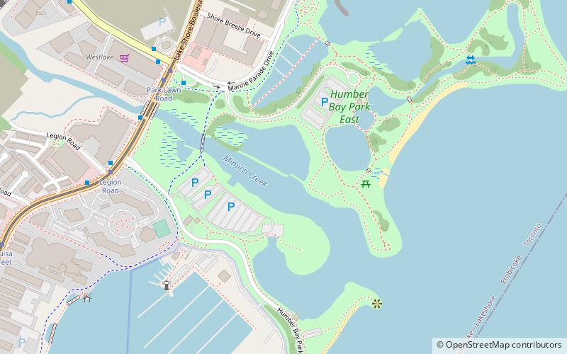
Map
Gallery
Facts and practical information
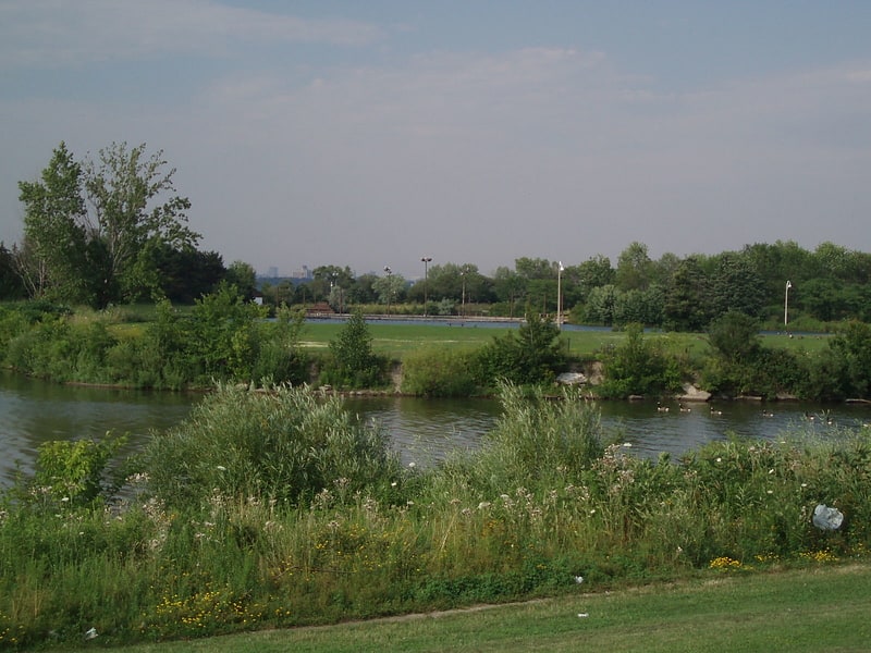
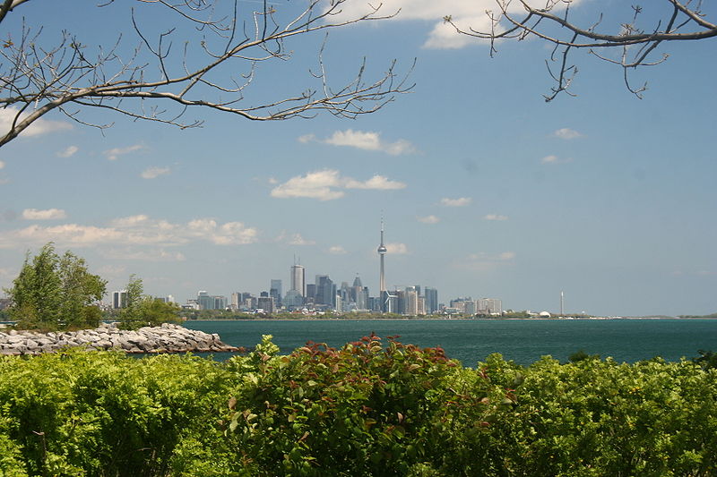
Humber Bay Park is a waterfront park located in Etobicoke, part of Toronto, Ontario, Canada. The park consists of two landspits situated at the mouth of Mimico Creek. The park is south of Lake Shore Boulevard West, near Park Lawn Road. Humber Bay Park East is 19 hectares, while Humber Bay Park West is 120 hectares. ()
Created: 1984Area: 0.54 mi²Elevation: 246 ft a.s.l.Coordinates: 43°37'14"N, 79°28'40"W
Getting there by public transportation
Public transportation stops near this location
- Bus
- Tram
- Train
 Bus
Bus
- Calculate routePark Lawn Road 6 min walk
- Calculate routeLegion Road 7 min walk
- Calculate routeStop 10 min walk
- Calculate routeMimico 26 min walk
- Calculate routeSouth Kingsway 28 min walk
- Calculate routeWindermere Avenue 32 min walk
Maps SubwayMaps
 Streetcar systemMaps
 PATH
PATH
SubwayMapsStreetcar systemMapsPATHDay trips


Frequently Asked Questions (FAQ)
Which popular attractions are close to Humber Bay Park?
Nearby attractions include Ontario Food Terminal, Toronto (18 min walk), The Queensway–Humber Bay, Toronto (19 min walk), The Palace Pier, Toronto (21 min walk), Humber Bay Arch Bridge, Toronto (22 min walk).
How to get to Humber Bay Park by public transport?
The nearest stations to Humber Bay Park:
Tram
Train
Bus
Tram
- Park Lawn Road • Lines: 501, 501;301 (6 min walk)
- Legion Road • Lines: 501, 501;301 (7 min walk)
Train
- Mimico (26 min walk)
Bus
- South Kingsway • Lines: 80A (28 min walk)
- Windermere Avenue • Lines: 80A (32 min walk)