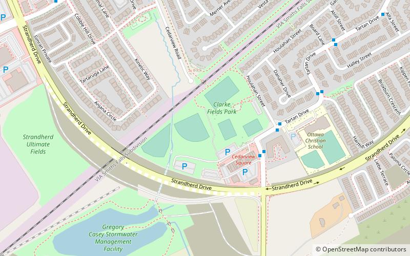
Clarke Fields Park, Ottawa
Map
Facts and practical information
Clarke Fields Park is a park in the west-end of Barrhaven, Ontario, Canada, located at 93 Houlahan Street. The park features several soccer fields, one baseball diamond, a playground, a bike path, and a BMX track. The park is currently maintained by the City of Ottawa. ()
Elevation: 302 ft a.s.l.Coordinates: 45°15'41"N, 75°46'12"W
Getting there by public transportation
Public transportation stops near this location
- Bus
 Bus
Bus
- Calculate routeTartan / Strandherd 7 min walk
Day trips


Frequently Asked Questions (FAQ)
How to get to Clarke Fields Park by public transport?
The nearest stations to Clarke Fields Park:
Bus
Bus
- Tartan / Strandherd • Lines: 170, 173, 273 (7 min walk)