Cedarhill Estate, Ottawa
Map
Facts and practical information
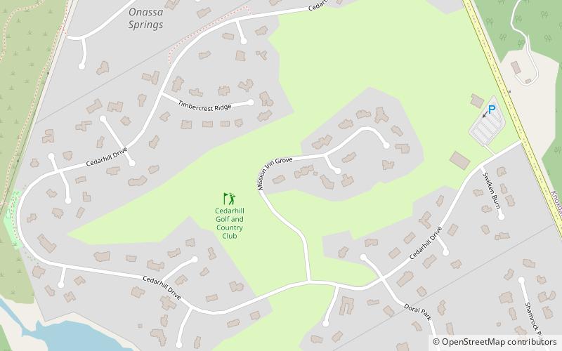
Cedarhill Estates is an neighbourhood located in Barrhaven Ward in the west end of Ottawa. Prior to amalgamation in 2001, it was located in Nepean. Together with Orchard Estates and the Onassa Springs development, it is located within the western part of the Ottawa Greenbelt. It is bordered by Fallowfield Road to the south, Cedarview Road to the east, and by Highway 416 to the north and west. It is located northwest of the Barrhaven suburb of the city. The neighbourhood surrounds the Cedarhill Golf Course. The neighbourhood by two nearby interchanges via Highway 416. ()
Coordinates: 45°17'12"N, 75°47'33"W
Address
Cedarhill EstatesOttawa
ContactAdd
Social media
Add
Getting there by public transportation
Public transportation stops near this location
- Bus
 Bus
Bus
- Calculate routeCobble Hill / Fallowfield 22 min walk
- Calculate routeCedarview / Fallowfield 23 min walk
- Calculate routeLarkin / Fallowfield 26 min walk
Day trips


Frequently Asked Questions (FAQ)
How to get to Cedarhill Estate by public transport?
The nearest stations to Cedarhill Estate:
Bus
Bus
- Cobble Hill / Fallowfield • Lines: 272 (22 min walk)
- Cedarview / Fallowfield • Lines: 170, 270 (23 min walk)