Bridlewood, Ottawa
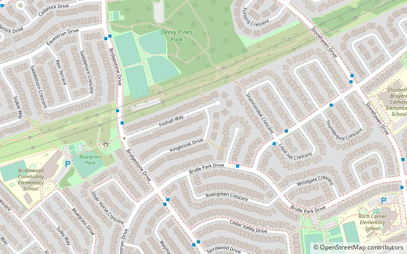
Map
Facts and practical information
Coordinates: 45°17'11"N, 75°51'16"W
Address
Emerald MeadowsOttawa
ContactAdd
Social media
Add
Getting there by public transportation
Public transportation stops near this location
- Bus
 Bus
Bus
- Calculate routeBridle Park / Black Rivers 3 min walk
- Calculate routeStonemeadow / Shannondoe 5 min walk
- Calculate routeBridgestone / Bridle Park 5 min walk
Day trips


Frequently Asked Questions (FAQ)
How to get to Bridlewood by public transport?
The nearest stations to Bridlewood:
Bus
Bus
- Bridle Park / Black Rivers • Lines: 257 (3 min walk)
- Stonemeadow / Shannondoe • Lines: 257 (5 min walk)