Matt Anthony Field, Ottawa
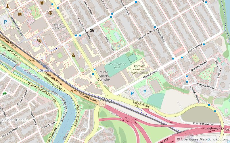
Map
Facts and practical information
Matt Anthony Field is a 1,500-seat multi-purpose stadium located on the University of Ottawa campus in Ottawa, Ontario. The stadium is home to the Ottawa Gee-Gees varsity women's soccer and rugby teams as well as the men's competitive club soccer and rugby teams. ()
Opened: 2001 (25 years ago)Capacity: 1500Coordinates: 45°25'13"N, 75°40'38"W
Address
Sandy HillOttawa
ContactAdd
Social media
Add
Getting there by public transportation
Public transportation stops near this location
- Bus
- Light rail
 Bus
Bus
- Calculate routeKing Edward / Templeton 2 min walk
- Calculate routeSomerset E / King Edward 5 min walk
- Calculate routeChapel / Mann 6 min walk
- Calculate routeUOttawa O-Train West/Ouest 7 min walk
- Calculate routeLees O-Train East/Est 11 min walk
Day trips


Frequently Asked Questions (FAQ)
Which popular attractions are close to Matt Anthony Field?
Nearby attractions include Iskcon Ottawa, Ottawa (5 min walk), St. Clement Parish, Ottawa (5 min walk), Lees Avenue, Ottawa (8 min walk), Corktown Footbridge, Ottawa (10 min walk).
How to get to Matt Anthony Field by public transport?
The nearest stations to Matt Anthony Field:
Bus
Light rail
Bus
- King Edward / Templeton • Lines: 39, 45, 56, 97 (2 min walk)
- Somerset E / King Edward • Lines: 16 (5 min walk)
Light rail
- UOttawa O-Train West/Ouest • Lines: 1 (7 min walk)
- Lees O-Train East/Est • Lines: 1 (11 min walk)