Toronto Lawn Tennis Club, Toronto
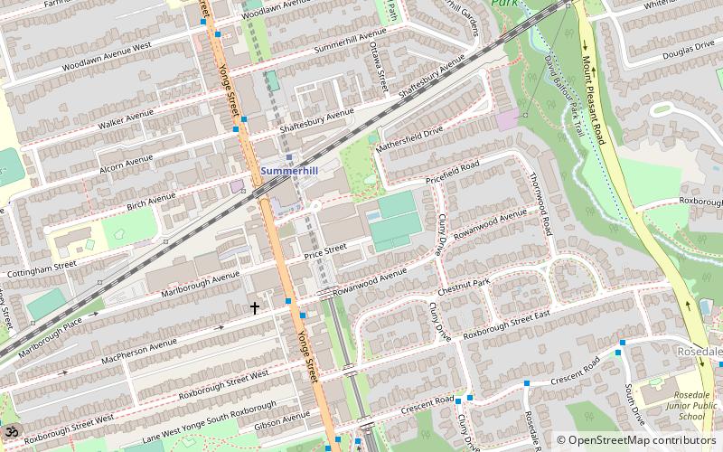
Map
Facts and practical information
The Toronto Lawn Tennis Club hosted the first ever National Tennis Championship of Canada and has hosted 2 Davis Cup ties. ()
Coordinates: 43°40'50"N, 79°23'20"W
Getting there by public transportation
Public transportation stops near this location
- Metro
- Bus
- Tram
 Metro
Metro
- Calculate routeSummerhill 3 min walk
- Calculate routeRosedale 8 min walk
- Calculate routeSt. Clair 15 min walk
- Calculate routeBloor-Yonge 18 min walk
- Calculate routeRosedale Station 7 min walk
- Calculate routeSouth Drive 9 min walk
- Calculate routeBelmont Street 12 min walk
- Calculate routeNew Street 12 min walk
- Calculate routeSt. Clair Station 14 min walk
- Calculate routeYonge Street 16 min walk
- Calculate routeDeer Park 17 min walk
- Calculate routeAvenue Road 20 min walk
Maps SubwayMaps
 Streetcar systemMaps
 PATH
PATH
SubwayMapsStreetcar systemMapsPATHDay trips


Frequently Asked Questions (FAQ)
Which popular attractions are close to Toronto Lawn Tennis Club?
Nearby attractions include Ramsden Park, Toronto (10 min walk), David A. Balfour Park, Toronto (10 min walk), Avenue Road Church, Toronto (13 min walk), Masonic Temple, Toronto (14 min walk).
How to get to Toronto Lawn Tennis Club by public transport?
The nearest stations to Toronto Lawn Tennis Club:
Metro
Bus
Tram
Metro
- Summerhill • Lines: 1 (3 min walk)
- Rosedale • Lines: 1 (8 min walk)
Bus
- Rosedale Station • Lines: 82 (7 min walk)
- South Drive • Lines: 82 (9 min walk)
Tram
- St. Clair Station • Lines: 512 (14 min walk)
- Yonge Street • Lines: 512 (16 min walk)