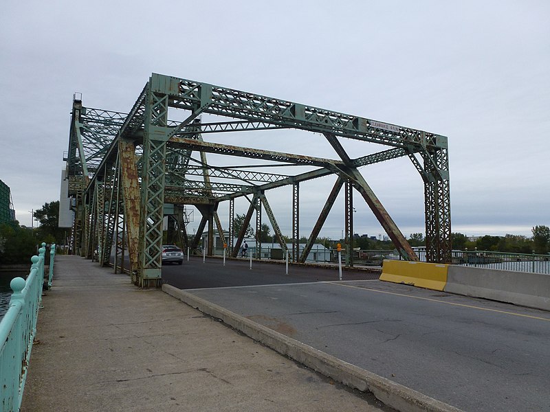
Cherry Street Strauss Trunnion Bascule Bridge, Toronto

Gallery (2)
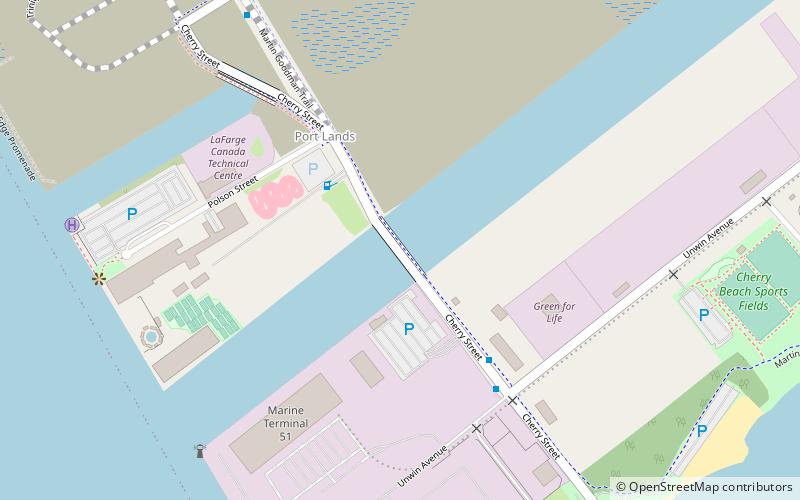
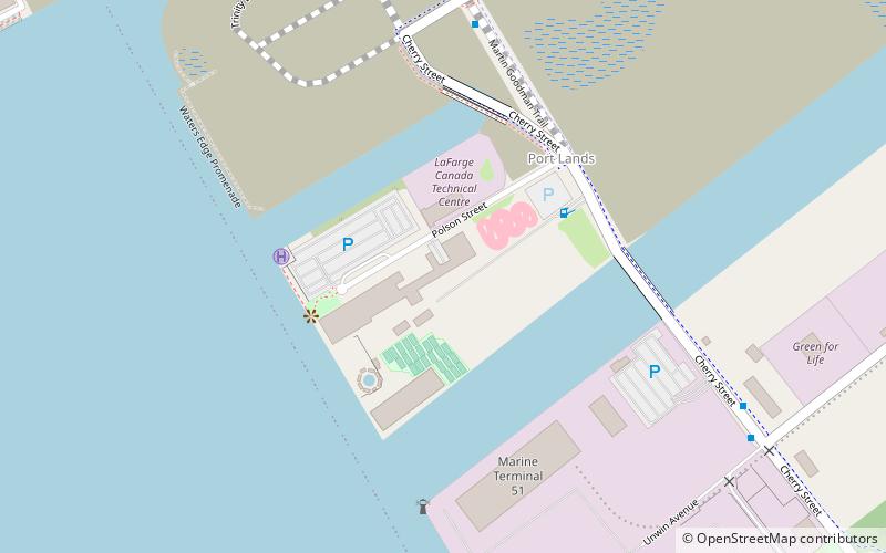
Map
Map
Gallery
Facts and practical information
The Cherry Street Strauss Trunnion Bascule Bridge is a bascule bridge and Warren truss in Toronto, Ontario, Canada. Located in the industrial Port Lands area, it carries Cherry Street over the Toronto Harbour Ship Channel and opens to allow ships to access the channel and the turning basin beyond. There are two bascule bridges on Cherry Street. The other, smaller bridge, crosses the Keating Channel, while this bridge crosses the Ship Channel. ()
Coordinates: 43°38'29"N, 79°20'56"W
Address
Port LandsToronto
ContactAdd
Social media
Add
Getting there by public transportation
Public transportation stops near this location
- Bus
- Tram
- Ferry
 Bus
Bus
- Calculate routeMill Street, Distillery Loop 20 min walk
- Calculate routeFront Street East 24 min walk
- Calculate routeParliament Street 27 min walk
- Calculate routeSackville Street 28 min walk
- Calculate routeWard's Island 21 min walk
- Calculate routeTrinity Street 22 min walk
- Calculate routeCherry Street 22 min walk
- Calculate routeBayview Avenue 23 min walk
- Calculate routeFront Street East 23 min walk
Maps SubwayMaps
 Streetcar systemMaps
 PATH
PATH
SubwayMapsStreetcar systemMapsPATHDay trips


Frequently Asked Questions (FAQ)
Which popular attractions are close to Cherry Street Strauss Trunnion Bascule Bridge?
Nearby attractions include Port of Toronto, Toronto (8 min walk), 39 Commissioner Street, Toronto (9 min walk), Cherry Beach, Toronto (11 min walk), Toronto waterfront, Toronto (13 min walk).
How to get to Cherry Street Strauss Trunnion Bascule Bridge by public transport?
The nearest stations to Cherry Street Strauss Trunnion Bascule Bridge:
Tram
Ferry
Bus
Tram
- Mill Street, Distillery Loop • Lines: 504A (20 min walk)
- Front Street East • Lines: 504A (24 min walk)
Ferry
- Ward's Island • Lines: Ward's Island (21 min walk)
Bus
- Trinity Street • Lines: 121 (22 min walk)
- Cherry Street • Lines: 121 (22 min walk)