Edmonton-Highlands-Norwood, Edmonton
Map
Facts and practical information
Edmonton-Highlands-Norwood is a provincial electoral district for the Legislative Assembly of Alberta, Canada. The district was created in 2004 when it was merged with Edmonton-Highlands and Edmonton-Norwood. ()
Coordinates: 53°34'12"N, 113°27'36"W
Address
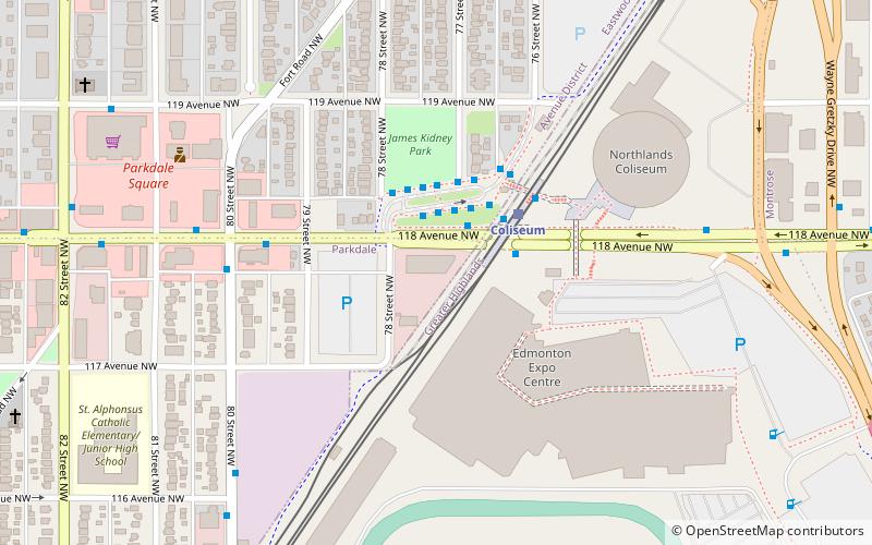
North Central Edmonton (Parkdale)Edmonton
ContactAdd
Social media
Add
Getting there by public transportation
Public transportation stops near this location
- Bus
- Light rail
 Bus
Bus
- Calculate routeColiseum Transit Centre 2 min walk
- Calculate route80 Street & 118 Ave 5 min walk
- Calculate route78 Street & 120 Ave 7 min walk
- Calculate route76 Street & 120 Ave 7 min walk
- Calculate routeColiseum 2 min walk
- Calculate routeStadium 21 min walk
Day trips


Frequently Asked Questions (FAQ)
Which popular attractions are close to Edmonton-Highlands-Norwood?
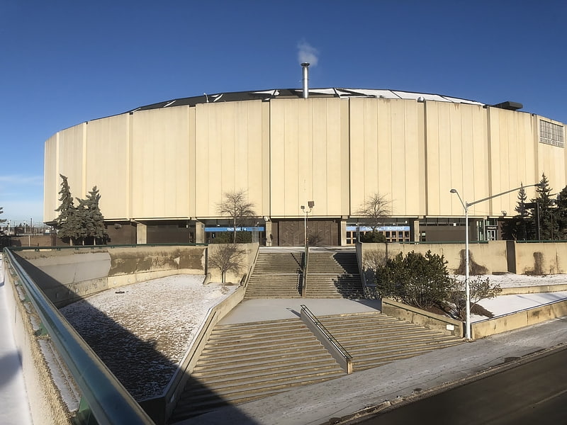
Nearby attractions include Edmonton Expo Centre, Edmonton (5 min walk), Northlands Coliseum, Edmonton (5 min walk), Eastwood, Edmonton (12 min walk), Parkdale, Edmonton (15 min walk).
How to get to Edmonton-Highlands-Norwood by public transport?
The nearest stations to Edmonton-Highlands-Norwood:
Bus
Light rail
Bus
- Coliseum Transit Centre • Lines: 2, 2-Owl, 5 (2 min walk)
- 80 Street & 118 Ave • Lines: 2, 5 (5 min walk)
Light rail
- Coliseum • Lines: 501 (2 min walk)
- Stadium • Lines: 501 (21 min walk)