Upper Beaches, Toronto

Facts and practical information
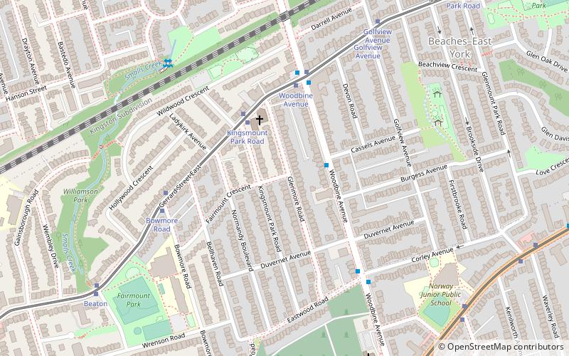
The Upper Beaches is a neighbourhood in Toronto, Ontario, Canada. It is directly north of the Beaches area. It stretches from Coxwell Avenue in the west to Victoria Park in the east. The southern border is Kingston Road, while the northern boundary is generally considered to be the Canadian National Railway tracks between Gerrard Street and Danforth Avenue. The western part of the area was originally called Norway, and the larger area was once part of the Town of East Toronto. The name "Upper Beaches" was first used by developers and real estate agents around the period of 2001 to 2003 for the selling of houses on redeveloped land in the area, and was used as a marketing tag to attract buyers. The area was never considered part of the Beaches neighbourhood but was close to it. The city's current name for this area is East End Danforth, though that is rarely used. The city also includes the buildings along and just north of Danforth Avenue in the neighbourhood. The western portion between Woodbine Avenue and Coxwell is referred to by the city as Woodbine Corridor. ()
East End (Upper Beaches)Toronto
- Metro
- Bus
- Tram
- Train
 Metro
Metro
- Calculate routeKingsmount Park Road 3 min walk
- Calculate routeWoodbine Avenue 5 min walk
- Calculate routeBowmore Road 5 min walk
- Calculate route500 Kingston Road 12 min walk
- Calculate route505 Kingston Road 12 min walk
- Calculate routeLee Avenue 14 min walk
- Calculate routeWoodbine Subway Station 14 min walk
- Calculate routeWoodbine 15 min walk
- Calculate routeCoxwell 19 min walk
- Calculate routeMain Street 23 min walk
- Calculate routeGreenwood 26 min walk
- Calculate routeDanforth 20 min walk
 SubwayMaps
 Streetcar systemMaps
 PATH
PATH


Frequently Asked Questions (FAQ)
Which popular attractions are close to Upper Beaches?
How to get to Upper Beaches by public transport?
Tram
- Kingsmount Park Road • Lines: 306, 506 (3 min walk)
- Woodbine Avenue • Lines: 306, 506 (5 min walk)
Bus
- 500 Kingston Road • Lines: 404 (12 min walk)
- 505 Kingston Road • Lines: 404 (12 min walk)
Metro
- Woodbine • Lines: 2 (15 min walk)
- Coxwell • Lines: 2 (19 min walk)
Train
- Danforth (20 min walk)