McCowan District Park, Toronto
Map
Facts and practical information
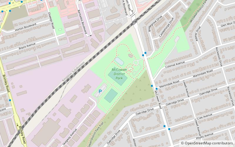
McCowan District Park is a 8.1-hectare recreational park in the Eglinton East neighbourhood of Scarborough, Toronto, Ontario, Canada. The park is located along McCowan Road, south of the Lakeshore East commuter rail line of GO Transit. ()
Area: 20.02 acres (0.0313 mi²)Elevation: 548 ft a.s.l.Coordinates: 43°44'1"N, 79°14'18"W
Address
150 McCowan RoadScarborough (Cliffcrest)Toronto
ContactAdd
Social media
Add
Getting there by public transportation
Public transportation stops near this location
- Bus
- Train
 Bus
Bus
- Calculate routeEglinton Avenue Road at McCowan Road 10 min walk
- Calculate routeEglinton Avenue East 12 min walk
- Calculate routeHorton Boulevard 12 min walk
- Calculate routeEglinton 14 min walk
- Calculate routeScarborough 36 min walk
Maps SubwayMaps
 Streetcar systemMaps
 PATH
PATH
SubwayMapsStreetcar systemMapsPATHDay trips


Frequently Asked Questions (FAQ)
Which popular attractions are close to McCowan District Park?
Nearby attractions include Eglinton East, Toronto (15 min walk), Cliffcrest, Toronto (23 min walk).
How to get to McCowan District Park by public transport?
The nearest stations to McCowan District Park:
Bus
Train
Bus
- Eglinton Avenue Road at McCowan Road • Lines: 198 (10 min walk)
- Eglinton Avenue East • Lines: 16 (12 min walk)
Train
- Eglinton (14 min walk)
- Scarborough (36 min walk)