Teglværksbroen, Copenhagen
Map

Map

Facts and practical information
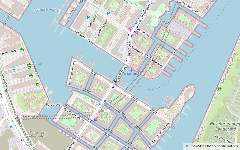
Teglværksbroen is a bascule bridge which connects Sluseholmen to Teglholmen in the South Harbour of Copenhagen, Denmark. It crosses the entrance to the Teglværkshavnen from which it takes its name. ()
Alternative names: Opened: 2011 (15 years ago)Length: 318 ftWidth: 66 ftCoordinates: 55°38'52"N, 12°33'2"E
Address
Copenhagen
ContactAdd
Social media
Add
Day trips
Teglværksbroen – popular in the area (distance from the attraction)
Nearby attractions include: Fisketorvet, Field's, DieselHouse, Vestre Cemetery.
Frequently Asked Questions (FAQ)
Which popular attractions are close to Teglværksbroen?
Nearby attractions include Sluseholmen Canal District, Copenhagen (4 min walk), Sluseholmen, Copenhagen (5 min walk), Fiskerhavnen, Copenhagen (14 min walk), Frederiks Brygge, Copenhagen (15 min walk).
How to get to Teglværksbroen by public transport?
The nearest stations to Teglværksbroen:
Ferry
Bus
Train
Light rail
Ferry
- Teglholmen • Lines: 991, 992 (1 min walk)
- Bryggebroen • Lines: 991, 992 (31 min walk)
Bus
- Alliancevej • Lines: 7A (4 min walk)
- Teglholm Allé • Lines: 7A (8 min walk)
Train
- Sluseholmen (7 min walk)
- Enghave Brygge (14 min walk)
Light rail
- Sydhavn • Lines: A, E (18 min walk)
- Sjælør • Lines: A, E (25 min walk)

 Metro
Metro


