Bryggebroen, Copenhagen
Map

Map

Facts and practical information
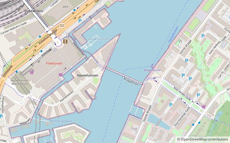
Bryggebroen is one of the new bicycle/pedestrian bridges in Copenhagen inner harbour and is a 190 metres combined pedestrian and bicyclist bridge directed east-west. The bridge is joined to Kalvebod Brygge and Cykelslangen bridge and Islands Brygge and thus connects Vesterbro on Zealand and Amager. The bridge has become a popular place for attaching love padlocks. ()
Day trips
Bryggebroen – popular in the area (distance from the attraction)
Nearby attractions include: Fisketorvet, DGI-byen, DieselHouse, Havneparken.
Frequently Asked Questions (FAQ)
Which popular attractions are close to Bryggebroen?
Nearby attractions include Bicycle Snake, Copenhagen (4 min walk), Kalvebod Brygge, Copenhagen (6 min walk), Mogens Dahl Koncertsal, Copenhagen (11 min walk), Hans Tausen's Church, Copenhagen (12 min walk).
How to get to Bryggebroen by public transport?
The nearest stations to Bryggebroen:
Ferry
Bus
Train
Light rail
Metro
Ferry
- Bryggebroen • Lines: 991, 992 (3 min walk)
- Det Kongelige Bibliotek • Lines: 991, 992 (24 min walk)
Bus
- Tivoli Hotel • Lines: 7A (6 min walk)
- Fisketorvet, Dybbølsbro • Lines: 7A (6 min walk)
Train
- Havneholmen (8 min walk)
- Enghave Brygge (16 min walk)
Light rail
- Dybbølsbro • Lines: A, B, Bx, C, E, H (9 min walk)
- Copenhagen Central Station • Lines: A, B, Bx, C, E, H (19 min walk)
Metro
- Copenhagen Central Station • Lines: M3, M4 (18 min walk)
- Islands Brygge • Lines: M1 (20 min walk)

 Metro
Metro


