Sluseholmen, Copenhagen
Map

Gallery

Facts and practical information
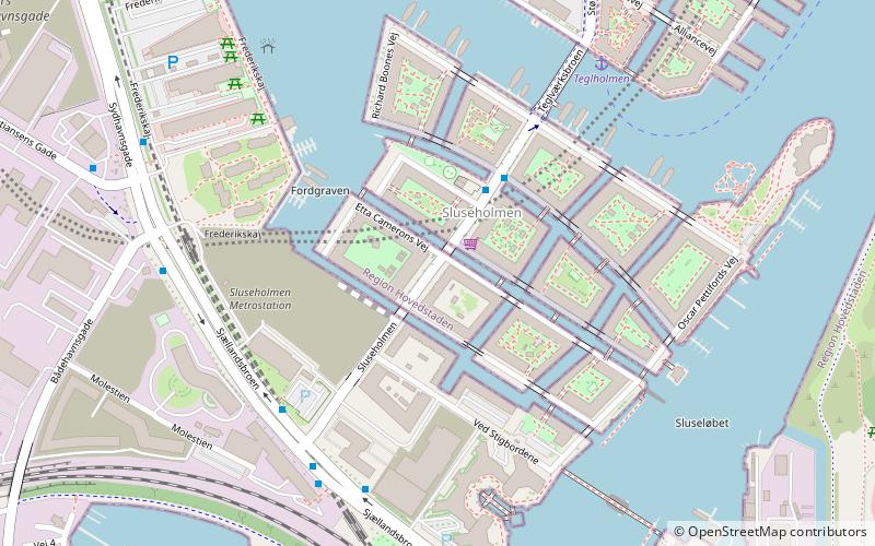
Sluseholmen is an artificial peninsula in the South Harbour of Copenhagen, Denmark. It takes its name from Slusen, a lock immediately to the south, regulating water levels in the harbor. Previously the site of heavy industry and part of the Southern Docklands of Port of Copenhagen, Sluseholmen has, since the turn of the millennium, undergone massive redevelopment, transforming it into a mainly residential district known for its canals and maritime atmosphere. It is connected to Teglholmen by the Teglværk Bridge. ()
Day trips
Sluseholmen – popular in the area (distance from the attraction)
Nearby attractions include: Fisketorvet, Field's, DieselHouse, Vestre Cemetery.
Frequently Asked Questions (FAQ)
Which popular attractions are close to Sluseholmen?
Nearby attractions include Sluseholmen Canal District, Copenhagen (3 min walk), Teglværksbroen, Copenhagen (5 min walk), Fiskerhavnen, Copenhagen (9 min walk), Frederiks Brygge, Copenhagen (19 min walk).
How to get to Sluseholmen by public transport?
The nearest stations to Sluseholmen:
Train
Bus
Ferry
Light rail
Train
- Sluseholmen (4 min walk)
- Mozarts Plads (15 min walk)
Bus
- Sluseholmen • Lines: 18 (5 min walk)
- Bådehavnsgade • Lines: 18 (7 min walk)
Ferry
- Teglholmen • Lines: 991, 992 (6 min walk)
- Bryggebroen • Lines: 991, 992 (36 min walk)
Light rail
- Sydhavn • Lines: A, E (20 min walk)
- Sjælør • Lines: A, E (24 min walk)

 Metro
Metro


