Vermlandsgade, Copenhagen

Gallery (1)
Map
Map
Facts and practical information
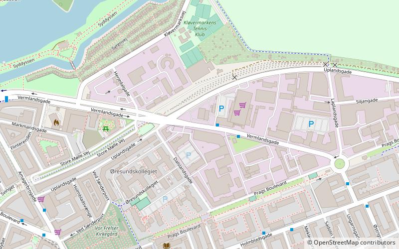
Vermlandsgade is a major street on the northeastern part of Amager, Copenhagen, Denmark. It runs from Christmas Møllers Plads in the west to a roundabout on Prags Boulevard in the east and then continues south to Holmbladsgade. ()
Coordinates: 55°40'6"N, 12°36'20"E
Address
Amager Øst (Uplands)Copenhagen
ContactAdd
Social media
Add
Getting there by public transportation
Public transportation stops near this location
- Metro
- Bus
- Ferry
 Metro
Metro
- Calculate routeSønderport 9 min walk
- Calculate routeAmagerbro St. 10 min walk
- Calculate routeAmagerfælledvej 11 min walk
- Calculate routeTingvej 14 min walk
- Calculate routeAmagerbro 9 min walk
- Calculate routeLergravsparken 16 min walk
- Calculate routeChristianshavn 16 min walk
- Calculate routeIslands Brygge 22 min walk
- Calculate routeKnippelsbro 22 min walk
- Calculate routeNyhavn 23 min walk
- Calculate routeOperaen 25 min walk
- Calculate routeDet Kongelige Bibliotek 26 min walk
Maps Metro
Metro
MetroDay trips


Frequently Asked Questions (FAQ)
Which popular attractions are close to Vermlandsgade?
Nearby attractions include Kvarterhuset, Copenhagen (6 min walk), Holmbladsgade, Copenhagen (6 min walk), Nathanael's Church, Copenhagen (6 min walk), Our Saviour's Cemetery, Copenhagen (7 min walk).
How to get to Vermlandsgade by public transport?
The nearest stations to Vermlandsgade:
Bus
Metro
Ferry
Bus
- Sønderport • Lines: 5C (9 min walk)
- Amagerbro St. • Lines: 250S, 5C (10 min walk)
Metro
- Amagerbro • Lines: M2 (9 min walk)
- Lergravsparken • Lines: M2 (16 min walk)
Ferry
- Knippelsbro • Lines: 991, 992 (22 min walk)
- Nyhavn • Lines: 991, 992 (23 min walk)