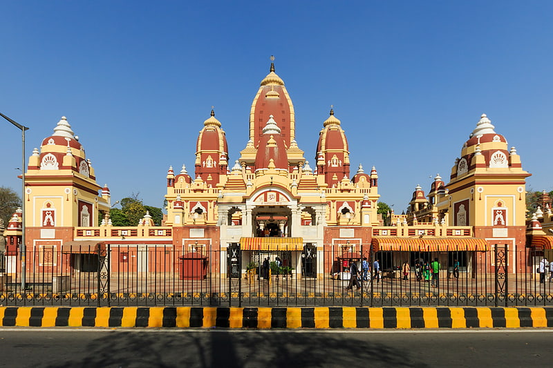
Jhandewalan Temple, Delhi
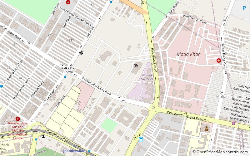
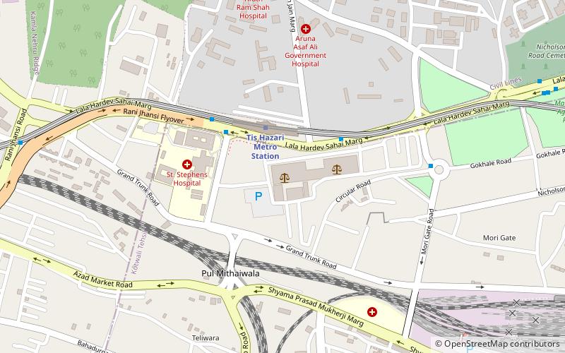
Map
Facts and practical information
The Jhandewalan Temple is a Hindu temple near Karol Bagh in Delhi, India dedicated to the goddess Aadi Shakti. It is among the oldest temple in Delhi and located on Jhandewala road. ()
Local name: झंडेवालान् मंदिर, नई दिल्लीCoordinates: 28°38'54"N, 77°12'12"E
Getting there by public transportation
Public transportation stops near this location
- Metro
- Bus
- Train
 Metro
Metro
- Calculate routeJhandewalan 3 min walk
- Calculate routeRani Jhansi Road, Jhandewalan 6 min walk
- Calculate routePaharganj bus stand 7 min walk
- Calculate routeMeghdoot Bhawan 9 min walk
- Calculate routeJhandewalan 9 min walk
- Calculate routeRamakrishna Ashram Marg 18 min walk
- Calculate routeKarol Bagh 25 min walk
- Calculate routeNew Delhi 32 min walk
- Calculate routeDelhi Kishanganj 27 min walk
- Calculate routeSadar Bazar 28 min walk
- Calculate routeNew Delhi 31 min walk
- Calculate routeDelhi Sarai Rohilla 38 min walk
Maps Metro
Metro
MetroDay trips


Frequently Asked Questions (FAQ)
Which popular attractions are close to Jhandewalan Temple?
Nearby attractions include Qadam Sharif, Delhi (14 min walk), Ajmal Khan Park, Delhi (14 min walk), Ramakrishna Mission New Delhi, Delhi (19 min walk), Paharganj, Delhi (21 min walk).
How to get to Jhandewalan Temple by public transport?
The nearest stations to Jhandewalan Temple:
Bus
Metro
Train
Bus
- Jhandewalan • Lines: 610 (3 min walk)
- Rani Jhansi Road, Jhandewalan • Lines: 610 (6 min walk)
Metro
- Jhandewalan • Lines: Blue Line (9 min walk)
- Ramakrishna Ashram Marg • Lines: Blue Line (18 min walk)
Train
- Delhi Kishanganj (27 min walk)
- Sadar Bazar (28 min walk)