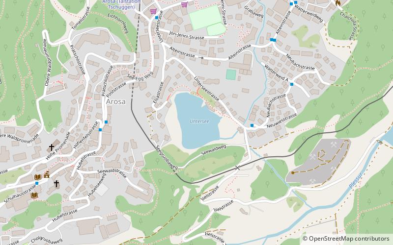
Untersee, Arosa
#4 among attractions in Arosa
![Untersee location map](https://tzmedia.b-cdn.net/media/images/static-maps/ch/46_7791_9_68165.jpg)
Facts and practical information
Untersee is a mountain bathing lake located at 1691 m in Arosa in the Swiss canton of Graubünden.
Arosa Switzerland
Arosa plan & book
Unleash the traveler in you — discover the cheapest flight deals, find the perfect hotel or hostel nearby, and search for the best car rental prices. Travel at your own pace to discover new places and enjoy your journey.
Untersee – popular in the area (distance from the attraction)
Nearby attractions include: Arosa Lenzerheide, Obersee, Aroser Weisshorn, Langwieser Viaduct.
3.4 miWWinter sport, Ski areaArosa Lenzerheide
87 min walk • Nestled in the heart of the Swiss Alps, Arosa Lenzerheide stands as a premier ski area, offering a sublime blend of snow-covered slopes, pristine winter landscapes, and state-of-the-art facilities. This dual-region resort, connected by the Urdenbahn cable car, boasts...
~1970 ftNNature, Natural attraction, LakeObersee, Arosa
10 min walk • Nestled in the serene mountain landscape of Arosa, Switzerland, the Obersee is a pristine alpine lake that beckons to nature lovers and outdoor enthusiasts alike. This tranquil body of water is surrounded by lush forests and rugged peaks, providing a picturesque...
2.2 miWAlpine mountain with cable-car accessAroser Weisshorn
55 min walk • Nestled in the breathtaking Swiss Alps, the Aroser Weisshorn stands as a majestic testament to the grandeur of nature. This impressive mountain, part of the Plessur range in the canton of Graubünden, Switzerland, soars to an altitude of 2,653 meters, offering...
2.9 miNBridgeLangwieser Viaduct
74 min walk • The Langwieser Viaduct is a single track reinforced concrete railway bridge spanning the Plessur River and the Sapünerbach, near Langwies, in the Canton of Graubünden, Switzerland.
4.3 miSWNature, Natural attraction, MountainAroser Rothorn
110 min walk • The Aroser Rothorn is the highest mountain of the Plessur Alps. It is located between Arosa and Lenzerheide in the canton of Graubünden and with a summit elevation of 2,980 metres above sea level.
0.5 miNWNature, Natural attraction, MountainTschuggen, Arosa
14 min walk • The Tschuggen is a mountain of the Plessur Alps, overlooking Arosa in the Swiss canton of Graubünden. A gondola lift and a chairlift link the top of the mountain with the town and resort of Arosa — the base station of the chairlift is near to Arosa railway station.
2.9 miSNature, Natural attraction, MountainValbellahorn
74 min walk • The Valbellahorn is a mountain of the Plessur Alps, located between Arosa and Wiesen in the canton of Graubünden.
2.7 miSNature, Natural attraction, MountainSandhubel
69 min walk • The Sandhubel is a mountain of the Plessur Alps, located south of Arosa in the canton of Graubünden. It lies north of the Guggernellgrat.
4.9 miWNature, Natural attraction, MountainGürgaletsch
124 min walk • The Gürgaletsch is a mountain of the Plessur Alps, located between Churwalden and Tschiertschen in the Swiss canton of Graubünden.
3.2 miNBridgeGründjitobel Viaduct
82 min walk • The Gründjitobel Viaduct is a single track reinforced concrete railway bridge, spanning the Gründjitobelbach near Langwies, in the Canton of Graubünden, Switzerland. Designed by Hermann Schürch, it was built between late June 1913 and early July 1914 by Müller, Zeerleder und Gobat, for the Chur–Arosa railway.
2.5 miSENature, Natural attraction, MountainAmselflue
64 min walk • The Amselflue is a mountain of the Plessur Alps, overlooking Arosa in the canton of Graubünden. The main summit has an elevation of 2,781 metres, while the eastern summit, located directly above the Maienfelder Furgga, is 2,768 metre high.