Piz Tomül, Vals
#2 among attractions in Vals
![Piz Tomül location map](https://tzmedia.b-cdn.net/media/images/static-maps/ch/46_6234_9_22853.jpg)
Facts and practical information
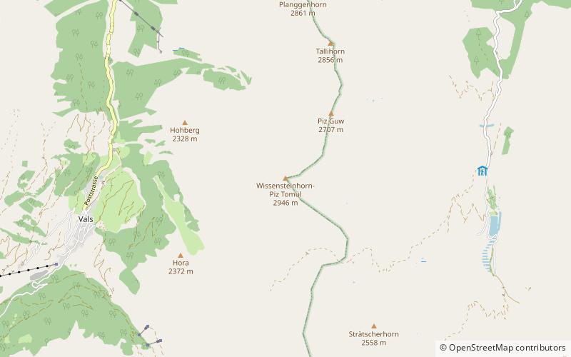
Piz Tomül is a mountain of the Lepontine Alps, overlooking Vals in the canton of Graubünden. With an altitude of 2,946 metres above sea level, it is the highest summit of the range lying north of Tomülpass. ()
Vals Switzerland
Vals plan & book
Unleash the traveler in you — discover the cheapest flight deals, find the perfect hotel or hostel nearby, and search for the best car rental prices. Travel at your own pace to discover new places and enjoy your journey.
Piz Tomül – popular in the area (distance from the attraction)
Nearby attractions include: Guraletschsee, Splügen Castle, Fanellhorn, Amperveilsee.
6.1 miSWNature, Natural attraction, LakeGuraletschsee
156 min walk • Guraletschsee is a lake above Vals in the canton of Grisons, Switzerland. The lake lies entirely on territory of the municipality of Vals. The water from the lake runs down north and is suspected to be divertet to Lake Zervreila at the level of its dam.
6.8 miSEForts and castlesSplügen Castle
175 min walk • The ruins of the former Splügen Castle lie east of the village of Splügen in the Rheinwald forest in the Swiss canton of Graubünden. It is the only castle in the valley.
7 miSWNature, Natural attraction, MountainFanellhorn
179 min walk • The Fanellhorn is a mountain in the Lepontine Alps of Graubünden, Switzerland, south of Vals.
5.1 miSWNature, Natural attraction, LakeAmperveilsee
131 min walk • Amperveilsee is a lake above Vals in the canton of Grisons, Switzerland. A popular hike starts at Zervreila, passes the three remote lakes Guraletschsee, Amperveilsee and Selvasee and descends via Selva Alp to Vals. Vals is famous for its spa.
3.3 miSNature, Natural attraction, MountainBärenhorn
85 min walk • The Bärenhorn is a mountain of the Lepontine Alps, situated between Vals and Nufenen in Graubünden, on territory of both municipalities. The northeastern face lies on territory of Safien. A popular hike starts at Zervreila, passes three remote lakes and descends via Selva Alp to Vals. Vals is famous for its spa.
5.4 miSENature, Natural attraction, MountainTeurihorn
137 min walk • The Teurihorn is a mountain of the Swiss Lepontine Alps, overlooking Splügen in the canton of Graubünden. It is located between the valleys of the Stutzbach and the Steilerbach, south of the Alperschällihorn.
5.7 miNWNature, Natural attraction, ValleyVals Valley
145 min walk • The Vals Valley is located in the canton of Graubünden in Switzerland.
3.8 miENature, Natural attraction, MountainBruschghorn
96 min walk • The Bruschghorn is a mountain of the Lepontine Alps, overlooking Thalkirch in the Swiss canton of Graubünden. With a height of 3,056 metres above sea level, the Bruschghorn is the culminating point of the range lying between the Safiental and the Domleschg valley.
4.5 miSENature, Natural attraction, MountainAlperschällihorn
115 min walk • Alperschällihorn is a mountain of the Lepontine Alps, overlooking Splügen in the canton of Graubünden. The mountains is situated between the Safien valley and the Hinterrhein valley.
4.9 miWNature, Natural attraction, MountainPiz Aul, Vals
125 min walk • Piz Aul is a mountain of the Lepontine Alps, overlooking Vals in the canton of Graubünden.
4.4 miENature, Natural attraction, MountainPizzas d'Anarosa
112 min walk • The Pizzas d'Anarosa is a mountain of the Swiss Lepontine Alps, located north of Splügen in the canton of Graubünden. It lies between the Safiental and the Hinterrhein valley.