Blinnenhorn
#156 among destinations in Switzerland


Facts and practical information
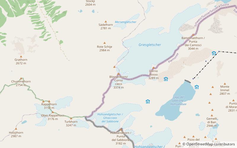
The Blinnenhorn or Corno Cieco is a mountain in the Lepontine Alps, located on the border between Italy and Switzerland. On the north-east side lies the Gries Glacier. ()
ValaisSwitzerland
Blinnenhorn – popular in the area (distance from the attraction)
Nearby attractions include: Mässersee, Griessee, Nufenenstock, Pizzo Gallina.
 Nature, Natural attraction, Lake
Mässersee
159 min walk • Mässersee is the smallest of four mountain lakes in the upper Binntal of the canton of Valais, Switzerland.
 Nature, Natural attraction, Lake
Griessee
95 min walk • Griessee is a lake in Valais, Switzerland. The reservoir is located in the municipality of Ulrichen and can be reached by road from Nufenen Pass. The lake is fed by the Gries Glacier. Its surface area is 55.5 ha. The gravity dam Gries was built in 1965.
 Nature, Natural attraction, Mountain
Nufenenstock
121 min walk • The Nufenestock is a mountain of the Lepontine Alps, located on the border between the Swiss cantons of Valais and Ticino. It lies between the Nufenen Pass and the Passo del Corno. On its south-west side it overlooks the lake of Gries.
 Nature, Natural attraction, Mountain
Pizzo Gallina
159 min walk • Pizzo Gallina is a 3,061-metre-high mountain in the Lepontine Alps of Switzerland, overlooking the Nufenen Pass. Administratively, the summit is located on the border between the municipality of Obergoms, to the north-west and in the canton of Valais, and the municipality of Bedretto, to the south-east and in the canton of Ticino.
 Nature, Natural attraction, Mountain
Gross Schinhorn
128 min walk • The Gross Schinhorn is a 2,939-metre-high mountain of the Lepontine Alps, located on the Swiss-Italian border. A lower summit named Klein Schinhorn lies north of the Gross Schinhorn. The two summits are referred as the Schinhörner.
 Nature, Natural attraction, Mountain pass
Nufenen Pass
133 min walk • Nufenen Pass is the highest mountain pass with a paved road within Switzerland. It lies between the summits of Pizzo Gallina and the Nufenenstock.
 Nature, Natural attraction, Mountain
Rappehorn
53 min walk • The Rappehorn is a mountain of the Lepontine Alps, located in the canton of Valais, west of the Blinnenhorn.
 Nature, Natural attraction, Lake
Geisspfadsee
149 min walk • Geisspfadsee is a lake in Valais, Switzerland. Its surface area is 18 ha. The lake is located in the municipality of Binn, at an elevation of 2439 m. It drains into Züesee. The nearby border to Italy can be crossed at two mountain passes: Geisspfadpass and Grampielpass. The name 'geisspfad' means, only goat may pass.
 Nature, Natural attraction, Valley
Binntal, Binn
176 min walk • The Binn Valley is a valley of the Alps, located on the north side of the Lepontine Alps in the Swiss canton of Valais. The valley is drained by the Binna, a tributary of the Rhone, at Grengiols. The valley is named after Binn, the main settlement.
 Nature, Natural attraction, Natural feature
Gries Glacier
32 min walk • The Gries Glacier is a 5 km long glacier situated in the Lepontine Alps in the canton of Valais in Switzerland. In 1973 it had an area of 6.23 km². In 2008 it had an area of 5.26 km².
 Nature, Natural attraction, Mountain
Pizzo Nero
172 min walk • Pizzo Nero is a mountain of the Lepontine Alps, located on the border between the Swiss cantons of Valais and Ticino. Its summit is the tripoint between the valleys of Geretal, Gonerli and Bedretto.
