Pizzo Gallina
#855 among destinations in Switzerland

Facts and practical information
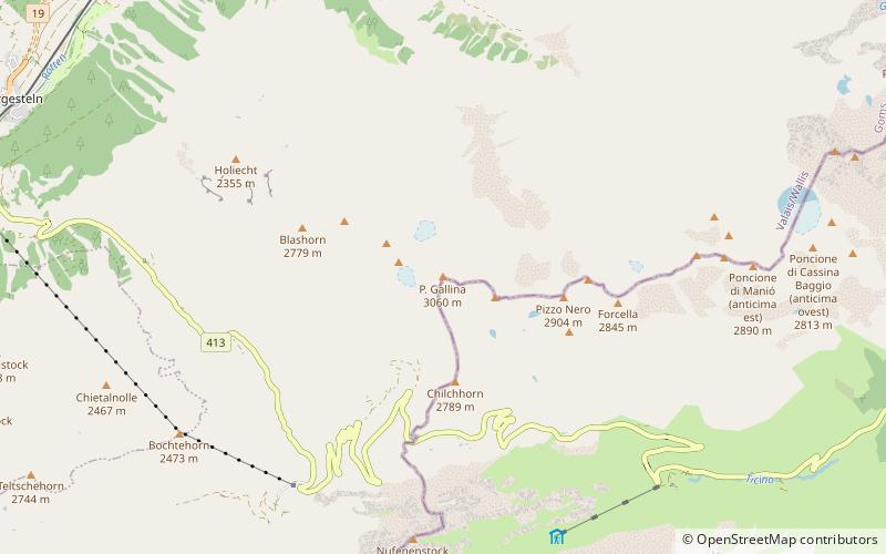
Pizzo Gallina is a 3,061-metre-high mountain in the Lepontine Alps of Switzerland, overlooking the Nufenen Pass. ()
ValaisSwitzerland
Pizzo Gallina plan & book
Unleash the traveler in you — discover the cheapest flight deals, find the perfect hotel or hostel nearby, and search for the best car rental prices. Travel at your own pace to discover new places and enjoy your journey.
Pizzo Gallina – popular in the area (distance from the attraction)
Nearby attractions include: Sidelhorn, Totesee, Pizzo Rotondo, Griessee.
 Nature, Natural attraction, Mountain
Sidelhorn
141 min walk • The Sidelhorn is a mountain of the Bernese Alps, located west of the Grimsel Pass. It lies at the eastern end of the mountain chain between the Unteraar Glacier and the Rhone valley, named Aargrat.
 Nature, Natural attraction, Lake
Totesee
132 min walk • Totesee is a small natural lake at the Grimsel Pass in Switzerland. The lake lies immediately to the south of the natural watershed and cantonal boundary at the pass.
 Nature, Natural attraction, Mountain
Pizzo Rotondo
99 min walk • Pizzo Rotondo is a mountain in the Lepontine Alps. At 3,190 metres above sea level, it is the highest mountain lying on the border between the cantons of Ticino and Valais, as well as the highest summit of the Lepontine Alps lying between Nufenen Pass and Lukmanier Pass.
 Nature, Natural attraction, Lake
Griessee
71 min walk • Griessee is a lake in Valais, Switzerland. The reservoir is located in the municipality of Ulrichen and can be reached by road from Nufenen Pass. The lake is fed by the Gries Glacier. Its surface area is 55.5 ha. The gravity dam Gries was built in 1965.
 Nature, Natural attraction, Mountain
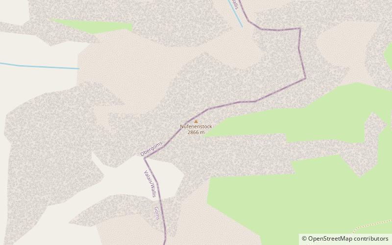
Nufenenstock
50 min walk • The Nufenestock is a mountain of the Lepontine Alps, located on the border between the Swiss cantons of Valais and Ticino. It lies between the Nufenen Pass and the Passo del Corno. On its south-west side it overlooks the lake of Gries.
 Nature, Natural attraction, Mountain
Chüebodenhorn
78 min walk • The Chüebodenhorn is a 3,070 metres high mountain in the Lepontine Alps, located on the border between the cantons of Valais and Ticino.
 Nature, Natural attraction, Mountain pass
Hotel Grimsel Passhöhe
136 min walk • The Grimsel Pass is a mountain pass in Switzerland, crossing the Bernese Alps at an elevation of 2,164 metres. The pass connects the Haslital, the upper valley of the river Aare, with the upper valley of the Rhône.
 Nature, Natural attraction, Mountain
Muttenhorn
101 min walk • The Muttenhorn is a mountain in the Lepontine Alps, located on the border between the cantons of Valais and Uri. At 3,099 metres above sea level, it overlooks the south side of Furka Pass.
 Nature, Natural attraction, Mountain
Leckihorn
114 min walk • The Leckihorn is a mountain in the Lepontine Alps, located on the border between the cantons of Valais and Uri. Its summit is also named Gross Leckihorn to distinguish it from a lower summit named Chli Leckihorn.
 Nature, Natural attraction, Mountain pass
Nufenen Pass
32 min walk • Nufenen Pass is the highest mountain pass with a paved road within Switzerland. It lies between the summits of Pizzo Gallina and the Nufenenstock.
 Nature, Natural attraction, Mountain
Witenwasserenstock
117 min walk • The Witenwasserenstock is a peak between the Swiss cantons of Valais and Uri, located in the Lepontine Alps. Close to the summit lies the tripoint border between the cantons of Valais, Uri and Ticino and the triple watershed of the Rhine, Po and Rhône basins.


