Nufenen Pass
#1040 among destinations in Switzerland


Facts and practical information
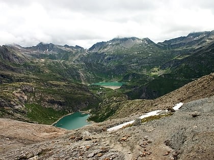
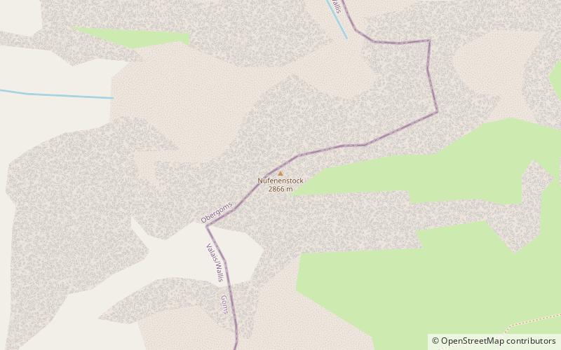
Nufenen Pass is the highest mountain pass with a paved road within Switzerland. It lies between the summits of Pizzo Gallina and the Nufenenstock. ()
ValaisSwitzerland
Nufenen Pass – popular in the area (distance from the attraction)
Nearby attractions include: Blinnenhorn, Sidelhorn, Lago del Zött, Pizzo Rotondo.
 Nature, Natural attraction, Mountain
Blinnenhorn
133 min walk • The Blinnenhorn or Corno Cieco is a mountain in the Lepontine Alps, located on the border between Italy and Switzerland. On the north-east side lies the Gries Glacier.
 Nature, Natural attraction, Mountain
Sidelhorn
162 min walk • The Sidelhorn is a mountain of the Bernese Alps, located west of the Grimsel Pass. It lies at the eastern end of the mountain chain between the Unteraar Glacier and the Rhone valley, named Aargrat.
 Nature, Natural attraction, Lake
Lago del Zött
160 min walk • Lago del Zött is a reservoir in the canton of Ticino, Switzerland, with a surface area of 0.13 km². Its 36 m arch dam was completed in 1967 and holds a volume of 1.65 mio m³.
 Nature, Natural attraction, Mountain
Pizzo Rotondo
120 min walk • Pizzo Rotondo is a mountain in the Lepontine Alps. At 3,190 metres above sea level, it is the highest mountain lying on the border between the cantons of Ticino and Valais, as well as the highest summit of the Lepontine Alps lying between Nufenen Pass and Lukmanier Pass.
 Nature, Natural attraction, Lake
Griessee
41 min walk • Griessee is a lake in Valais, Switzerland. The reservoir is located in the municipality of Ulrichen and can be reached by road from Nufenen Pass. The lake is fed by the Gries Glacier. Its surface area is 55.5 ha. The gravity dam Gries was built in 1965.
 Nature, Natural attraction, Mountain
Nufenenstock
18 min walk • The Nufenestock is a mountain of the Lepontine Alps, located on the border between the Swiss cantons of Valais and Ticino. It lies between the Nufenen Pass and the Passo del Corno. On its south-west side it overlooks the lake of Gries.
 Nature, Natural attraction, Mountain
Chüebodenhorn
97 min walk • The Chüebodenhorn is a 3,070 metres high mountain in the Lepontine Alps, located on the border between the cantons of Valais and Ticino.
 Nature, Natural attraction, Mountain
Muttenhorn
132 min walk • The Muttenhorn is a mountain in the Lepontine Alps, located on the border between the cantons of Valais and Uri. At 3,099 metres above sea level, it overlooks the south side of Furka Pass.
 Nature, Natural attraction, Lake
Lago dei Cavagnöö
143 min walk • Lago dei Cavagnöö is a lake in the municipality of Bignasco, Ticino, Switzerland. Its surface area is 0.46 km2. The arch dam Cavagnoli has a height 111 m. It was completed in 1968.
 Nature, Natural attraction, Mountain
Pizzo Gallina
32 min walk • Pizzo Gallina is a 3,061-metre-high mountain in the Lepontine Alps of Switzerland, overlooking the Nufenen Pass. Administratively, the summit is located on the border between the municipality of Obergoms, to the north-west and in the canton of Valais, and the municipality of Bedretto, to the south-east and in the canton of Ticino.
 Nature, Natural attraction, Mountain
Leckihorn
140 min walk • The Leckihorn is a mountain in the Lepontine Alps, located on the border between the cantons of Valais and Uri. Its summit is also named Gross Leckihorn to distinguish it from a lower summit named Chli Leckihorn.
