Griessee
#580 among destinations in Switzerland


Facts and practical information
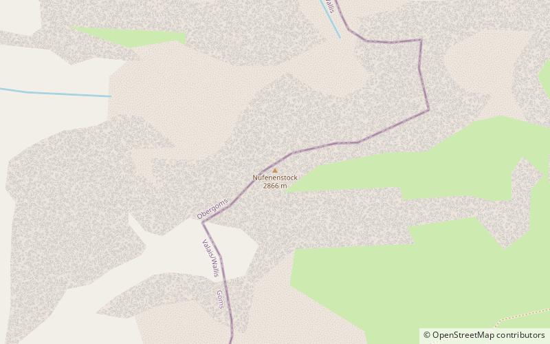
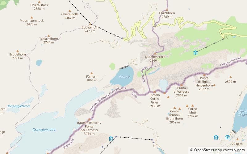
Griessee is a lake in Valais, Switzerland. The reservoir is located in the municipality of Ulrichen and can be reached by road from Nufenen Pass. The lake is fed by the Gries Glacier. Its surface area is 55.5 ha. ()
ValaisSwitzerland
Griessee plan & book
Unleash the traveler in you — discover the cheapest flight deals, find the perfect hotel or hostel nearby, and search for the best car rental prices. Travel at your own pace to discover new places and enjoy your journey.
Griessee – popular in the area (distance from the attraction)
Nearby attractions include: Blinnenhorn, Pizzo Rotondo, Nufenenstock, Chüebodenhorn.
3.7 miSW
Nature, Natural attraction, MountainBlinnenhorn
95 min walk • The Blinnenhorn or Corno Cieco is a mountain in the Lepontine Alps, located on the border between Italy and Switzerland. On the north-east side lies the Gries Glacier.
6.2 miNE
Nature, Natural attraction, MountainPizzo Rotondo
158 min walk • Pizzo Rotondo is a mountain in the Lepontine Alps. At 3,190 metres above sea level, it is the highest mountain lying on the border between the cantons of Ticino and Valais, as well as the highest summit of the Lepontine Alps lying between Nufenen Pass and Lukmanier Pass.
1 miNE
Nature, Natural attraction, MountainNufenenstock
27 min walk • The Nufenestock is a mountain of the Lepontine Alps, located on the border between the Swiss cantons of Valais and Ticino. It lies between the Nufenen Pass and the Passo del Corno. On its south-west side it overlooks the lake of Gries.
5.3 miNE
Nature, Natural attraction, MountainChüebodenhorn
135 min walk • The Chüebodenhorn is a 3,070 metres high mountain in the Lepontine Alps, located on the border between the cantons of Valais and Ticino.
2.8 miN
Nature, Natural attraction, MountainPizzo Gallina
71 min walk • Pizzo Gallina is a 3,061-metre-high mountain in the Lepontine Alps of Switzerland, overlooking the Nufenen Pass. Administratively, the summit is located on the border between the municipality of Obergoms, to the north-west and in the canton of Valais, and the municipality of Bedretto, to the south-east and in the canton of Ticino.
7 miNE
Nature, Natural attraction, MountainLeckihorn
179 min walk • The Leckihorn is a mountain in the Lepontine Alps, located on the border between the cantons of Valais and Uri. Its summit is also named Gross Leckihorn to distinguish it from a lower summit named Chli Leckihorn.
1.6 miNE
Nature, Natural attraction, Mountain passNufenen Pass
41 min walk • Nufenen Pass is the highest mountain pass with a paved road within Switzerland. It lies between the summits of Pizzo Gallina and the Nufenenstock.
5.7 miSW
Nature, Natural attraction, MountainRappehorn
146 min walk • The Rappehorn is a mountain of the Lepontine Alps, located in the canton of Valais, west of the Blinnenhorn.
7 miNE
Nature, Natural attraction, MountainWitenwasserenstock
178 min walk • The Witenwasserenstock is a peak between the Swiss cantons of Valais and Uri, located in the Lepontine Alps. Close to the summit lies the tripoint border between the cantons of Valais, Uri and Ticino and the triple watershed of the Rhine, Po and Rhône basins.
2.4 miSW
Nature, Natural attraction, Natural featureGries Glacier
63 min walk • The Gries Glacier is a 5 km long glacier situated in the Lepontine Alps in the canton of Valais in Switzerland. In 1973 it had an area of 6.23 km². In 2008 it had an area of 5.26 km².
6.9 miNE
Nature, Natural attraction, MountainPizzo Pesciora
176 min walk • Pizzo Pesciora is a mountain in the Lepontine Alps, located on the border between the Swiss cantons of Valais and Ticino. It lies north of Bedretto, on the ridge between the Witenwasserenstock and Pizzo Rotondo.
