St. Hilarius Parish Church of Näfels
#485 among destinations in Switzerland


Facts and practical information
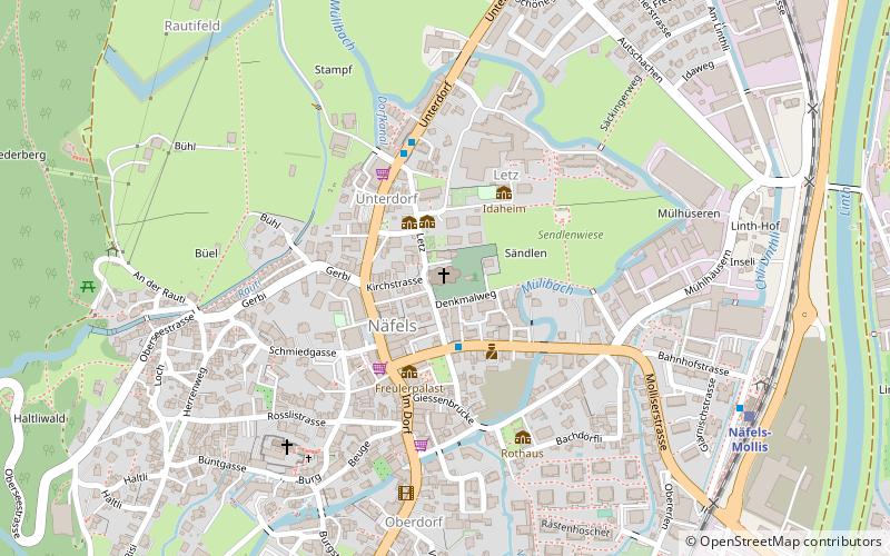
St. Hilarius Parish Church of Näfels is a Catholic church in Näfels, Glarus Nord, Glarus Canton, Switzerland. It is listed as a Cultural Property of National Significance. ()
GlarusSwitzerland
St. Hilarius Parish Church of Näfels – popular in the area (distance from the attraction)
Nearby attractions include: Amden, Obersee, Stadtkirche Glarus, Rautispitz.
4 miNEWinter sport, Ski areaAmden
102 min walk • Nestled in the serene Swiss Alps, Amden is a picturesque village that offers an idyllic escape for ski enthusiasts and nature lovers alike. This charming ski area is renowned for its family-friendly slopes and breathtaking panoramic views, making it a hidden gem for...
2.5 miSWNature, Natural attraction, LakeObersee
65 min walk • Obersee is a lake on Oberseealp in the Canton of Glarus, Switzerland. Its surface area is 24 ha. There is a hotel on the lakeside which overlooks the lake and the Brünnelistock. During a cold and dry winter, there is a chance of black ice developing.
4.2 miSChurchStadtkirche Glarus, Glarus
106 min walk • The Stadtkirche Glarus is the main Reformed church for the city of Glarus in the canton of Glarus in Switzerland.
2.6 miSWNature, Natural attraction, MountainRautispitz
67 min walk • The Rautispitz is a mountain of the Schwyzer Alps, overlooking Netstal in the canton of Glarus. It lies between the Obersee and the Klöntalersee and culminates at 2,283 metres above sea level.
4.7 miNNature, Natural attraction, MountainFederispitz
121 min walk • The Federispitz is a mountain of the Appenzell Alps, overlooking the Walensee in the canton of St. Gallen. It lies south of the Speer above the municipality of Schänis.
3 miSENature, Natural attraction, MountainFronalpstock
78 min walk • The Fronalpstock is a mountain of the Glarus Alps, located east of Glarus in the canton of Glarus.
5.2 miWNature, Natural attraction, MountainZindlenspitz
132 min walk • The Zindlenspitz is a mountain of the Schwyzer Alps, located on the border between the Swiss cantons of Schwyz and Glarus. It lies on the range between the Wägitalersee and the Obersee, south of the Brünnelistock.
3.3 miENature, Natural attraction, LakeTalalpsee
84 min walk • Talalpsee or Talsee is a lake at an elevation of 1086 m above Filzbach in the Canton of Glarus, Switzerland. Its surface area is 3.2 ha.
5.2 miWNature, Natural attraction, MountainSchiberg
133 min walk • The Schiberg is a mountain of the Schwyz Alps, located on the border between the Swiss cantons of Schwyz and Glarus. It overlooks the Wägitalersee on its west side.
4 miNWNature, Natural attraction, MountainPlanggenstock
102 min walk • The Planggenstock is a mountain of the Schwyzer Alps, located south of Bilten in the canton of Glarus. It lies between the valley of the Linth and the valley of Niederurnen.
4.7 miWNature, Natural attraction, MountainChöpfenberg
119 min walk • The Chöpfenberg is a mountain of the Schwyzer Alps, located on the border between the Swiss cantons of Schwyz and Glarus. It lies on the range north of the Mutteristock, between the valleys of the Wägitalersee and the Linth.