Zindlenspitz
#610 among destinations in Switzerland
![Zindlenspitz location map](https://tzmedia.b-cdn.net/media/images/static-maps/ch/47_0763_8_95977.jpg)
Facts and practical information
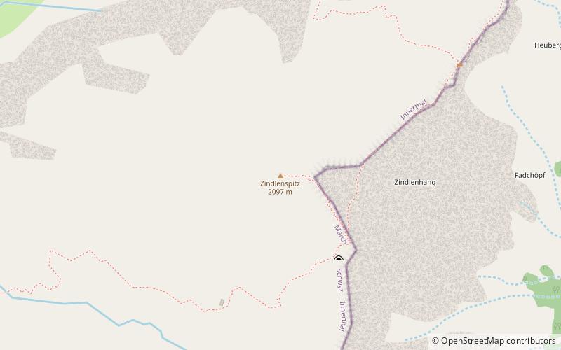
The Zindlenspitz is a mountain of the Schwyzer Alps, located on the border between the Swiss cantons of Schwyz and Glarus. It lies on the range between the Wägitalersee and the Obersee, south of the Brünnelistock. ()
SchwyzSwitzerland
Zindlenspitz plan & book
Unleash the traveler in you — discover the cheapest flight deals, find the perfect hotel or hostel nearby, and search for the best car rental prices. Travel at your own pace to discover new places and enjoy your journey.
Zindlenspitz – popular in the area (distance from the attraction)
Nearby attractions include: Klöntalersee, Wägitalersee, Obersee, Stadtkirche Glarus.
3.5 miSNature, Natural attraction, LakeKlöntalersee
90 min walk • Nestled in the heart of the Glarus Alps, Klöntalersee is a serene and picturesque lake in Switzerland that captivates visitors with its tranquil beauty. This magnificent body of water is a natural reservoir, stretching approximately 3.3 kilometers in length...
2.2 miNWNature, Natural attraction, LakeWägitalersee
56 min walk • Nestled in the heart of the Swiss Alps, Wägitalersee is a serene mountain lake that epitomizes the pristine beauty of Switzerland's natural landscapes. This idyllic lake is situated in the canton of Schwyz and is a hidden gem for outdoor enthusiasts and those seeking...
2.7 miENature, Natural attraction, LakeObersee
69 min walk • Obersee is a lake on Oberseealp in the Canton of Glarus, Switzerland. Its surface area is 24 ha. There is a hotel on the lakeside which overlooks the lake and the Brünnelistock. During a cold and dry winter, there is a chance of black ice developing.
5.6 miSEChurchStadtkirche Glarus, Glarus
142 min walk • The Stadtkirche Glarus is the main Reformed church for the city of Glarus in the canton of Glarus in Switzerland.
3.2 miENature, Natural attraction, MountainRautispitz
83 min walk • The Rautispitz is a mountain of the Schwyzer Alps, overlooking Netstal in the canton of Glarus. It lies between the Obersee and the Klöntalersee and culminates at 2,283 metres above sea level.
5.6 miSNature, Natural attraction, MountainGlärnisch
144 min walk • The Glärnisch is a mountain massif of the Schwyz Alps, overlooking the valley of the Linth in the Swiss canton of Glarus. It consists of several summits, of which the highest, Bächistock, is 2,915 metres above sea level.
5.2 miEChurchSt. Hilarius Parish Church of Näfels
132 min walk • St. Hilarius Parish Church of Näfels is a Catholic church in Näfels, Glarus Nord, Glarus Canton, Switzerland. It is listed as a Cultural Property of National Significance.
5.1 miNWNature, Natural attraction, MountainChli Aubrig
130 min walk • The Chli Aubrig is a mountain of the Swiss Prealps, located between Euthal and Vorderthal in the canton of Schwyz. It lies west of the higher Gross Aubrig.
2.1 miSNature, Natural attraction, MountainMutteristock
53 min walk • The Mutteristock is a mountain in the Schwyzer Alps, which rises 2294 meters above sea level. It is located between the cantons of Glarus and Schwyz, Switzerland, overlooking the Wägitalersee and the Klöntalersee on its northern and southern side respectively.
4.4 miNWNature, Natural attraction, MountainGross Aubrig
112 min walk • The Gross Aubrig is a mountain of the Schwyzer Alps, overlooking the lake of Wägital in the canton of Schwyz. It lies north of the Fluebrig, on the range between the valley of the Sihl and the Wägital. Its child peak Chli Aubrig lies to the west.
1.2 miNNature, Natural attraction, MountainSchiberg
31 min walk • The Schiberg is a mountain of the Schwyz Alps, located on the border between the Swiss cantons of Schwyz and Glarus. It overlooks the Wägitalersee on its west side.