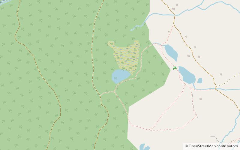
Lai Neir
#1059 among destinations in Switzerland
![Lai Neir location map](https://tzmedia.b-cdn.net/media/images/static-maps/ch/46_5348_9_63775.jpg)
Facts and practical information
Lai Neir is a small lake on Alp Flix, in the Grisons, Switzerland. It is listed in the Inventory of Raised and Transitional Bogs of National Importance. ()
GraubündenSwitzerland
Lai Neir – popular in the area (distance from the attraction)
Nearby attractions include: Lai Blos, Marmels Castle, Spliatsch Castle, Piz Ela.
~1010 ftNENature, Natural attraction, LakeLai Blos
5 min walk • Lai Blos or Lais Blos are two small lakes on Alp Flix, at an elevation of 1960 m, in the Grisons, Switzerland. They are located near to Lai Neir. The alp is listed in the Inventory of Mire Landscapes of Particular Beauty and National Importance.
2 miSForts and castlesMarmels Castle
51 min walk • Marmels Castle German: Burg Marmels is a ruined castle in the municipality of Marmorera in the district of Albula in the canton of Graubünden in Switzerland.
1.3 miSForts and castlesSpliatsch Castle
35 min walk • Spliatsch Castle is a ruined castle in the municipality of Surses in the Albula Region in the canton of Graubünden in Switzerland.
4.9 miNNature, Natural attraction, MountainPiz Ela
125 min walk • Piz Ela is a mountain in the Albula Alps, overlooking Bergün, in the Swiss canton of Graubünden. It is located in the center of the nature park Parc Ela. There is a lake called Lai Grond to the south of Piz Ela.
3.1 miENature, Natural attraction, MountainTschima da Flix
79 min walk • Tschima da Flix is a mountain of the Albula Alps, located between Piz Calderas and Piz d'Agnel, in the canton of Graubünden. On the northern side of the mountain lies a glacier named Vadret da Calderas.
4.7 miSWMountainPiz Scalotta
121 min walk • Piz Scalotta is a mountain of the Oberhalbstein Alps, located west of Bivio in the canton of Graubünden. It lies north of Piz Surparé.
4.4 miNWNatural featureOberhalbstein Alps
114 min walk • The Oberhalbstein Alps or Platta Group are a mountain range in the Alps of eastern Switzerland and northern Italy. They are considered to be part of the Central Eastern Alps.
4 miSEMountainPiz Neir, Sils im Engadin/Segl
103 min walk • Piz Neir is a mountain of the Albula Alps, overlooking Bivio in the canton of Graubünden. It lies on the group south of Piz d'Agnel.
4.7 miNEMountainPiz Salteras
119 min walk • Piz Salteras is a mountain of the Albula Alps, located between Tinizong and Preda in the canton of Graubünden.
4.5 miENature, Natural attraction, MountainPiz Surgonda
115 min walk • Piz Surgonda is a mountain of the Albula Alps, located north of the Julier Pass in the canton of Graubünden. It lies on the range surrounding the Val Bever, east of Piz d'Agnel.
2.8 miENature, Natural attraction, MountainPiz Calderas
71 min walk • Piz Calderas is a mountain of the Albula Alps, overlooking Mulegns in the canton of Graubünden. It is the highest summit of the group located between the Julier and Albula Pass. On its east side lies the Val Bever.