Lai Blos

Gallery (1)
Map
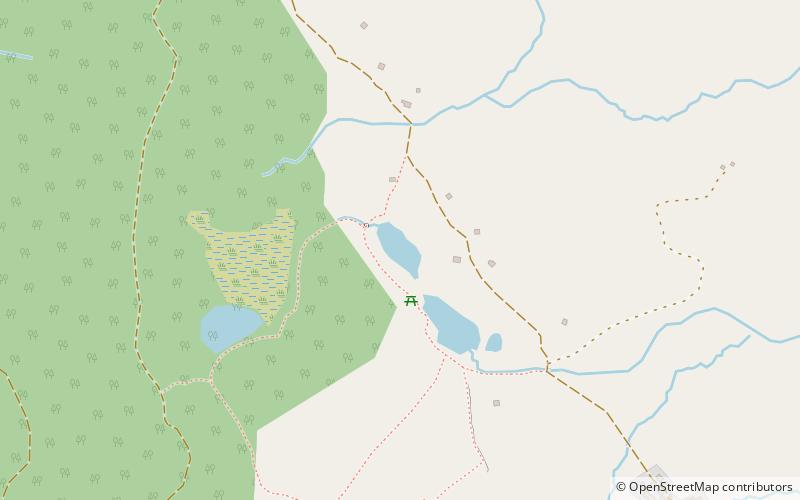
Map
Facts and practical information
Lai Blos or Lais Blos are two small lakes on Alp Flix, at an elevation of 1960 m, in the Grisons, Switzerland. They are located near to Lai Neir. ()
Elevation: 6440 ft a.s.l.Coordinates: 46°32'9"N, 9°38'29"E
Location
Graubünden
ContactAdd
Social media
Add
Day trips