Solavers Castle
#605 among destinations in Switzerland


Facts and practical information
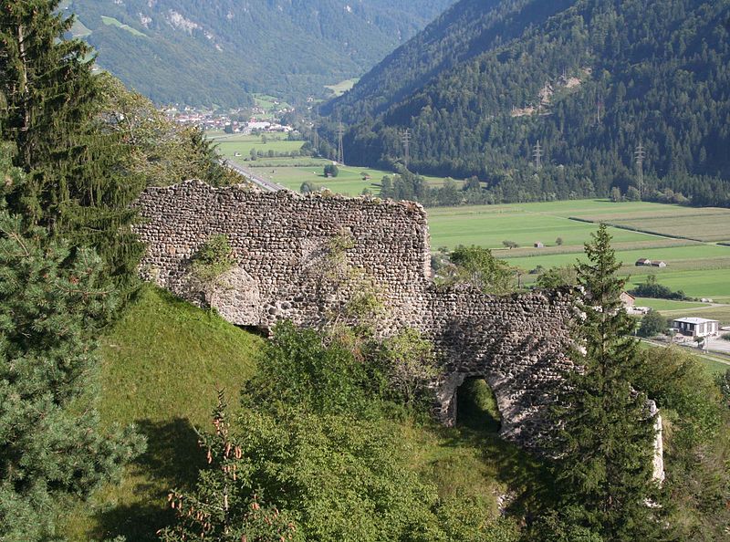
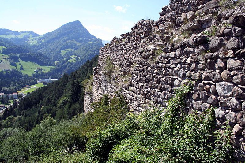
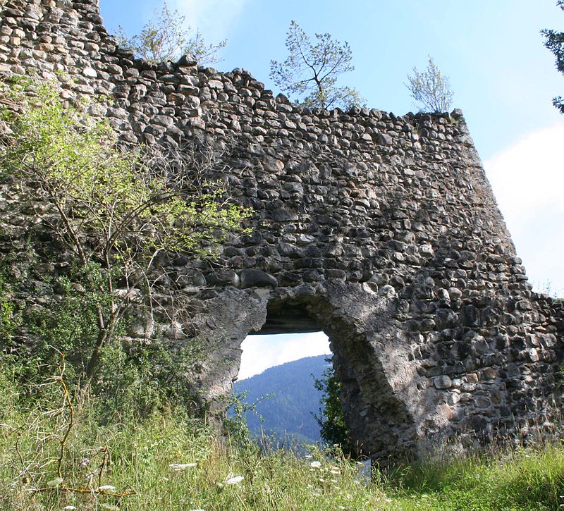
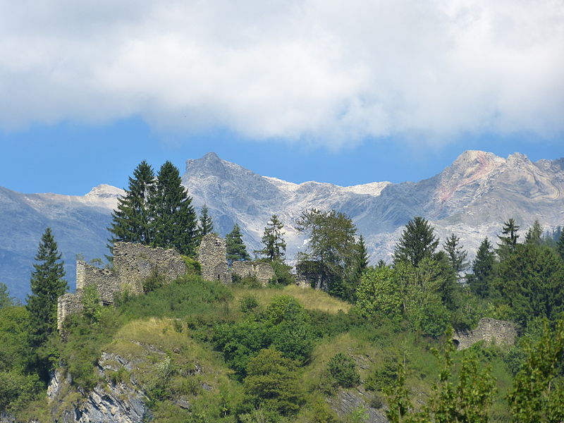
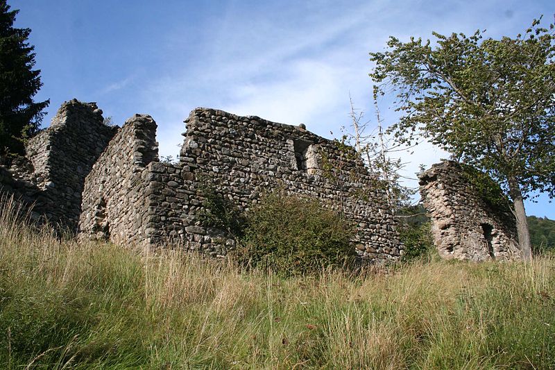
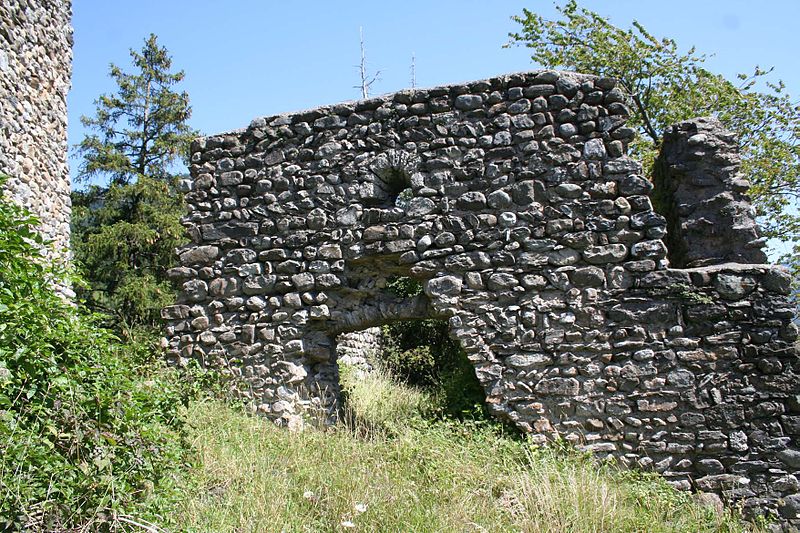
Solavers Castle is a castle in the municipality of Seewis im Prättigau of the Canton of Graubünden in Switzerland. ()
Solavers Castle plan & book
Unleash the traveler in you — discover the cheapest flight deals, find the perfect hotel or hostel nearby, and search for the best car rental prices. Travel at your own pace to discover new places and enjoy your journey.
Solavers Castle – popular in the area (distance from the attraction)
Nearby attractions include: Grüsch, Brandis Castle, Salginatobel Bridge, Schloss Marschlins.
 Village, Winter sport, Ski area
Grüsch
33 min walk • Grüsch, Switzerland, nestled within the picturesque Prättigau valley, is a charming ski area that beckons winter sports enthusiasts from around the globe. With its pristine slopes and state-of-the-art facilities, Grüsch serves as an idyllic destination for skiers...
 Forts and castles
Brandis Castle, Maienfeld
143 min walk • Brandis Castle or Maienfeld Castle is a castle in the municipality of Maienfeld of the Canton of Graubünden in Switzerland. It is a Swiss heritage site of national significance.
 Bridge
Salginatobel Bridge
89 min walk • Salginatobel Bridge is a reinforced concrete arch bridge designed by Swiss civil engineer Robert Maillart. It was constructed across an alpine ravine in the grisonian Prättigau, belonging to the municipality of Schiers, in Switzerland between 1929 and 1930.
 Forts and castles
Schloss Marschlins
89 min walk • Marschlins Castle is a castle in the village of Igis of the municipality of Landquart of the Canton of Graubünden in Switzerland. It is a Swiss heritage site of national significance. Marschlins Castle was the childhood home of feminist Meta von Salis.
 Forts and castles
Neu-Aspermont Castle, Jenins
102 min walk • Neu-Aspermont Castle is a ruined castle in the municipality of Jenins of the Canton of Graubünden in Switzerland. It is a Swiss heritage site of national significance.
 Natural feature, Nature, Natural attraction
Rätikon
146 min walk • The Rätikon is a mountain range of the Central Eastern Alps, located at the border between Vorarlberg, Liechtenstein and Graubünden. It is the geological border between the Eastern and Western Alps and stretches from the Montafon as far as the Rhine.
 Natural attraction, Park, Trail
Vilan, Malans
72 min walk • The Vilan is a mountain in the Rätikon range of the Alps, located north of Malans in the canton of Graubünden. It lies south of the Falknis, between the main Rhine valley and the Taschinas valley.
 Nature, Natural attraction, Mountain
Grauspitz
144 min walk • The Grauspitz is a mountain in the Rätikon range of the Alps, located on the border between Liechtenstein and Switzerland. With an elevation of 2,599 metres above sea level, the Grauspitz is the highest mountain in Liechtenstein. It is also the highest summit of the Rätikon range west of the Schesaplana massif.
 Forts and castles
Klingenhorn Castle
81 min walk • Klingenhorn Castle is a ruined castle in the municipality of Malans of the Canton of Graubünden in Switzerland.
 Nature, Natural attraction, Mountain
Naafkopf
144 min walk • The Naafkopf is a mountain in the Rätikon range of the Alps, located at the border between Austria, Liechtenstein and Switzerland.
 Nature, Natural attraction, Mountain
Sassauna
82 min walk • The Sassauna is a mountain in the Rätikon range of the Alps, overlooking Schiers in the Swiss canton of Graubünden.


