Gross Aubrig
#676 among destinations in Switzerland
Facts and practical information
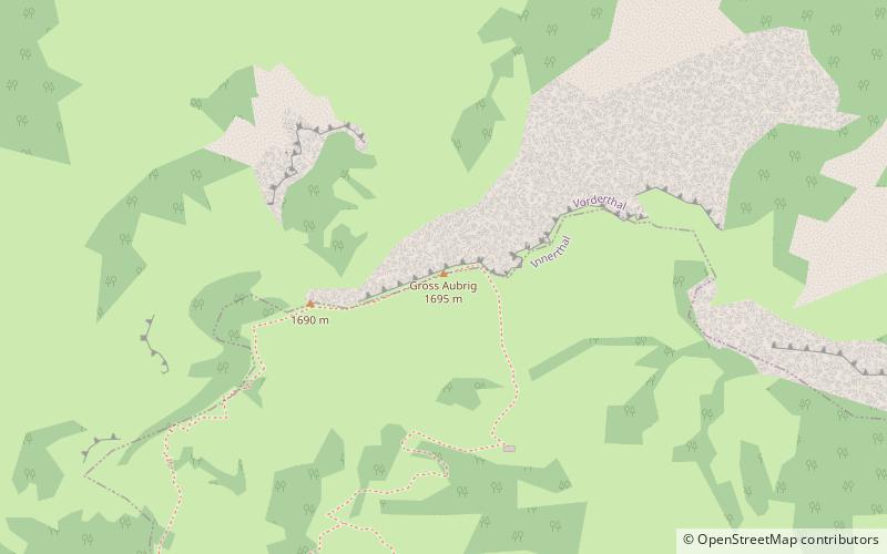
The Gross Aubrig is a mountain of the Schwyzer Alps, overlooking the lake of Wägital in the canton of Schwyz. It lies north of the Fluebrig, on the range between the valley of the Sihl and the Wägital. Its child peak Chli Aubrig lies to the west. ()
SchwyzSwitzerland
Gross Aubrig plan & book
Unleash the traveler in you — discover the cheapest flight deals, find the perfect hotel or hostel nearby, and search for the best car rental prices. Travel at your own pace to discover new places and enjoy your journey.
Gross Aubrig – popular in the area (distance from the attraction)
Nearby attractions include: Wägitalersee, Etzel Mountain, Sihlsee, Chli Aubrig.
- 2.2 miSENature, Natural attraction, Lake
Wägitalersee
58 min walk • Nestled in the heart of the Swiss Alps, Wägitalersee is a serene mountain lake that epitomizes the pristine beauty of Switzerland's natural landscapes. This idyllic lake is situated in the canton of Schwyz and is a hidden gem for outdoor enthusiasts and those seeking...
- 7 miNWNature, Natural attraction, Mountain
Etzel Mountain, Pfäffikon
180 min walk • The Etzel is a mountain on the south side of Lake Zürich in Switzerland. Although its elevation, of 1,098 metres, is relatively modest, it is notable for its aspect when viewed from the lake and its surroundings.
- 4.6 miW5-mile-long man-made reservoir and dam
Sihlsee
118 min walk • The Sihlsee is an artificial lake in the Swiss canton of Schwyz, near the town of Einsiedeln. The lake was created by damming the river Sihl and flooding a section of the upper Sihl Valley.
- 1 miWNature, Natural attraction, Mountain
Chli Aubrig
25 min walk • The Chli Aubrig is a mountain of the Swiss Prealps, located between Euthal and Vorderthal in the canton of Schwyz. It lies west of the higher Gross Aubrig.
- 4.4 miSENature, Natural attraction, Mountain
Zindlenspitz
112 min walk • The Zindlenspitz is a mountain of the Schwyzer Alps, located on the border between the Swiss cantons of Schwyz and Glarus. It lies on the range between the Wägitalersee and the Obersee, south of the Brünnelistock.
- 5.2 miSENature, Natural attraction, Mountain
Mutteristock
133 min walk • The Mutteristock is a mountain in the Schwyzer Alps, which rises 2294 meters above sea level. It is located between the cantons of Glarus and Schwyz, Switzerland, overlooking the Wägitalersee and the Klöntalersee on its northern and southern side respectively.
- 3.6 miENature, Natural attraction, Mountain
Schiberg
93 min walk • The Schiberg is a mountain of the Schwyz Alps, located on the border between the Swiss cantons of Schwyz and Glarus. It overlooks the Wägitalersee on its west side.
- 5.5 miENature, Natural attraction, Mountain
Planggenstock
140 min walk • The Planggenstock is a mountain of the Schwyzer Alps, located south of Bilten in the canton of Glarus. It lies between the valley of the Linth and the valley of Niederurnen.
- 4.1 miENature, Natural attraction, Mountain
Chöpfenberg
105 min walk • The Chöpfenberg is a mountain of the Schwyzer Alps, located on the border between the Swiss cantons of Schwyz and Glarus. It lies on the range north of the Mutteristock, between the valleys of the Wägitalersee and the Linth.
- 4.7 miSENature, Natural attraction, Mountain
Brünnelistock
119 min walk • The Brünnelistock is a mountain of the Schwyzer Alps, located on the border between the cantons of Schwyz and Glarus. It lies north of the Mutteristock, on the range between the Wägitalersee and the Obersee.
- 2 miNWMountain route with scenic views
Sattelegg Pass
51 min walk • Sattelegg Pass is a high mountain pass in the Alps in the canton of Schwyz in Switzerland, connecting Siebnen and Willerzell. The road has a maximum grade of 14 percent. On the Sattelegg is a restaurant, a small chapel, and a ski elevator.