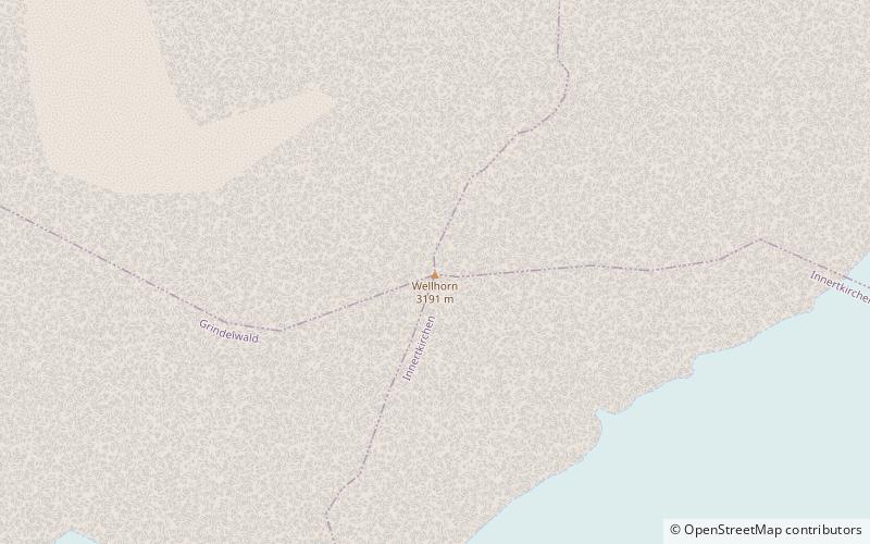
Wellhorn
#1402 among destinations in Switzerland

Facts and practical information
The Wellhorn is a mountain of the Bernese Alps, overlooking Rosenlaui in the Bernese Oberland. On its eastern side is the Rosenlaui Glacier. ()
BernSwitzerland
Wellhorn plan & book
Unleash the traveler in you — discover the cheapest flight deals, find the perfect hotel or hostel nearby, and search for the best car rental prices. Travel at your own pace to discover new places and enjoy your journey.
Wellhorn – popular in the area (distance from the attraction)
Nearby attractions include: First, Wetterhorn, Schwarzhorn, Rosenhorn.
 Summit with cable cars and dramatic views
First, Grindelwald
107 min walk • First is a mountain location and minor summit on the slopes of the Schwarzhorn in the Bernese Oberland. It is mostly known as a cable car station above Grindelwald and as a popular hiking area with the Bachalpsee in proximity.
 Nature, Natural attraction, Mountain
Wetterhorn, Grindelwald
45 min walk • The Wetterhorn is a peak in the Swiss Alps towering above the village of Grindelwald. Formerly known as Hasle Jungfrau, it is one of three summits on a mountain named the "Wetterhörner", the highest of which is the Mittelhorn and the lowest and most distant the Rosenhorn.
 Mountain with hiking and panoramic views
Schwarzhorn
97 min walk • The Schwarzhorn is a mountain of the Bernese Alps, located between Brienz and Grindelwald in the Bernese Oberland. With a height of 2,928 metres above sea level, it is the highest summit of the group north of the Grosse Scheidegg Pass.
 Nature, Natural attraction, Mountain
Rosenhorn
43 min walk • The Rosenhorn is a peak in the Bernese Alps in the Bernese Oberland. It is lowest of the three composing the Wetterhorner massif, and most distant from the alpine village of Grindelwald to the southwest.
 Nature, Natural attraction, Mountain
Mittelhorn
42 min walk • The Mittelhorn is a peak in the Swiss Alps close to the village of Grindelwald. It is the highest of the three composing the Wetterhorner massif.
 Alpine hut, Hiking
Gleckstein Hut
77 min walk • The Gleckstein Hut is a mountain hut of the Swiss Alpine Club, located east of Grindelwald in the canton of Bern. The hut lies at a height of 2,317 metres above sea level, above the Upper Grindelwald Glacier, at the foot of the Wetterhorn in the Bernese Alps.
 Nature, Natural attraction, Mountain
Tschingel
85 min walk • The Tschingel is a mountain of the Bernese Alps, overlooking Meiringen in the Bernese Oberland. It constitutes the eastern end of the Grindelgrat, a ridge descending from the Garzen summit. The summit is on the border between Meiringen and Schattenhalb municipalities.
 Alpine hut, Hiking
Dossen Hut
34 min walk • The Dossen Hut is a mountain hut of the Swiss Alpine Club, located south of Meiringen in the canton of Bern, Switzerland. It lies at a height of 2,663 metres above sea level, on the watershed between the Reichenbachtal and the Urbachtal, north of the Dossen.
 Nature, Natural attraction, Mountain
Dossen
29 min walk • The Dossen is a mountain in the Bernese Alps, overlooking Rosenlaui in the Bernese Oberland. It is located east of the Rosenlaui Glacier. The Dossen is composed of two summits: the northern summit and southern summit.
 Nature, Natural attraction, Mountain
Wildgärst
105 min walk • The Wildgärst is a mountain of the Bernese Alps, overlooking Lake Brienz in the Bernese Oberland. It lies north of the Schwarzhorn, on the range between Lake Brienz and the Grosse Scheidegg.
 Nature, Natural attraction, Valley
Reichenbachtal
44 min walk • Reichenbachtal is an Alpine valley in Oberhasli, canton of Berne, Switzerland. It is situated within the municipality of Schattenhalb, connecting Meiringen with the Grosse Scheidegg pass towards Grindelwald. Its water, the Rychenbach, forms the Reichenbach Fall before joining the Aare at Meiringen.


