Dent de Corjon
#1498 among destinations in Switzerland
![Dent de Corjon location map](https://tzmedia.b-cdn.net/media/images/static-maps/ch/46_45_7_03584.jpg)
Facts and practical information
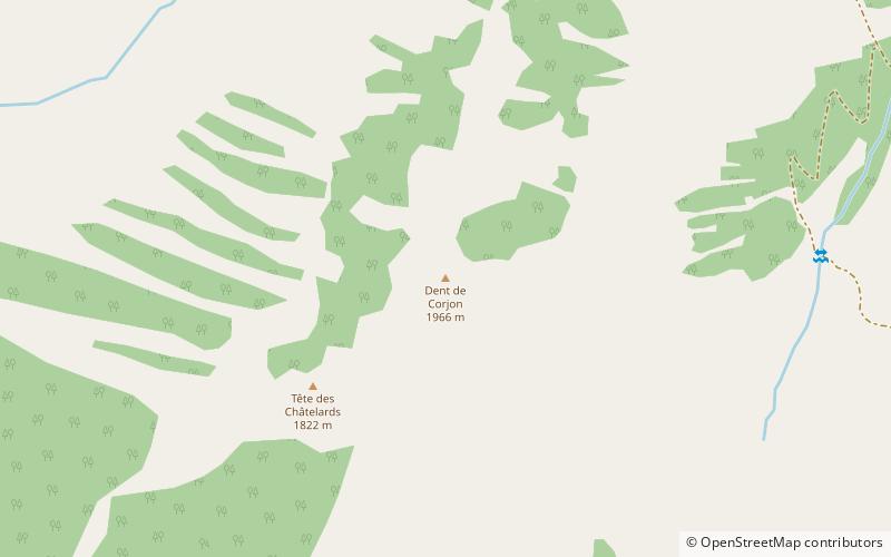
The Dent de Corjon is a mountain of the Swiss Prealps, located west of Rossinière in the canton of Vaud. It is the culminating point of the small range lying between the valley of L'Hongrin and the Sarine, north of the Lac de l'Hongrin. ()
VaudSwitzerland
Dent de Corjon plan & book
Unleash the traveler in you — discover the cheapest flight deals, find the perfect hotel or hostel nearby, and search for the best car rental prices. Travel at your own pace to discover new places and enjoy your journey.
Dent de Corjon – popular in the area (distance from the attraction)
Nearby attractions include: Rochers de Naye, Haut-Intyamon, Lac du Vernex, Dent de Lys.
3.1 miSWTowering peak with a railway to the topRochers de Naye, Montreux
79 min walk • The Rochers de Naye is a mountain of the Swiss Alps, overlooking Lake Geneva near Montreux and Villeneuve, in the canton of Vaud.
4.8 miNCity hallHaut-Intyamon
122 min walk • Nestled in the serene pre-Alpine valley of Gruyère in the canton of Fribourg, Haut-Intyamon is a picturesque municipality that captures the essence of Switzerland's bucolic charm. At the heart of this tranquil community lies the Haut-Intyamon City Hall, an emblem of...
1.9 miNENature, Natural attraction, LakeLac du Vernex, Rossinière
50 min walk • Lac du Vernex is a reservoir on the Saane/Sarine river at Rossinière, in the Pays d'Enhaut of the canton of Vaud. It lies at an elevation of 859 m above sea level, between the Pointe de Cray and Planachaux mountains.
4.3 miNNature, Natural attraction, MountainDent de Lys
110 min walk • The Dent de Lys is a mountain in the Bernese Alps, in the canton of Fribourg.
3.3 miNNature, Natural attraction, LakeLac de Lessoc
84 min walk • Lac de Lessoc is a reservoir on the Saane/Sarine river between Lessoc and Montbovon in the Canton of Fribourg, Switzerland. The lake's surface area is 20 ha. The Lessoc dam with a height of 33 m was completed in 1976.
2.9 miWNature, Natural attraction, MountainDent de Jaman
75 min walk • The Dent de Jaman is a mountain above Montreux, situated north of the Rochers de Naye.
3.1 miNWNature, Natural attraction, MountainCape au Moine
78 min walk • The Cape au Moine is a mountain of the Swiss Prealps, located on the border between the cantons of Vaud and Fribourg. It lies north of the Col de Jaman and south of the Col de Soladier, among of a crest of peaks extending roughly north into Fribourg to the Dent de Lys, on the range between Lake Geneva and the valley of Gruyère.
4.6 miSNature, Natural attraction, MountainTour de Famelon
119 min walk • The Tour de Famelon is a mountain of the Swiss Prealps, located north of Leysin in the canton of Vaud. It lies between the Tour de Mayen and the Pierre du Moëllé, on the range lying between the lake of Hongrin and the valley of Ormont Dessous and Ormont Dessus.
2.7 miSWNature, Natural attraction, MountainPointe d'Aveneyre
69 min walk • The Pointe d'Aveneyre is a mountain of the Swiss Prealps, located east of Villeneuve in the canton of Vaud. It lies south of the Rochers de Naye, on the range overlooking Lake Geneva.
4.4 miSNature, Natural attraction, MountainMont d'Or
113 min walk • Mont d'Or is a mountain of the Bernese Alps of Switzerland, overlooking Le Sépey in the canton of Vaud. It lies on the range between the Lac de l'Hongrin and the valley of Ormont-Dessous, and flanks the Col des Mosses pass.
2.6 miNEMemorial, Vernacular architectureGrand Chalet, Rossinière
66 min walk • The Grand Chalet of Rossinière is one of the oldest chalets in Switzerland, dating to the 18th century. It is located in Rossinière and classed as a historic monument. Claude Roy wrote of it: The Grand Chalet, a caravel washed up on a mountain, a Shinto temple.. With its architecture in white wood and balconies of lace.