East Park, Wolverhampton
Map
Facts and practical information
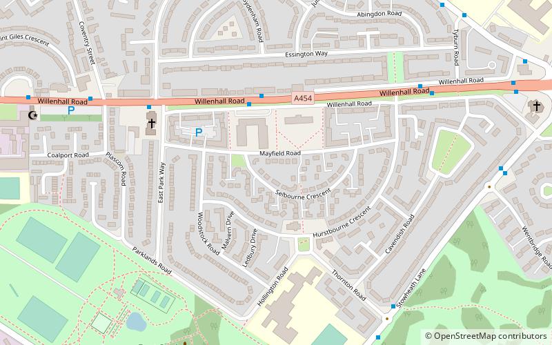
East Park is a park in Wolverhampton, England. The Wolverhampton ward population taken at the 2011 census was 12,497. Situated off Hickman Avenue, near Monmore Green stadium, the park has good transport links to the city centre. ()
Elevation: 456 ft a.s.l.Coordinates: 52°34'55"N, 2°5'38"W
Address
East ParkWolverhampton
ContactAdd
Social media
Add
Getting there by public transportation
Public transportation stops near this location
- Bus
- Tram
- Train
 Bus
Bus
- Calculate routeWillenhall Rd / Mayfield Medical Centre 3 min walk
- Calculate routeWillenhall Rd / East Park Way 6 min walk
- Calculate routeStowheath Lane / Thornton Rd 7 min walk
- Calculate routePriestfield 19 min walk
- Calculate routeThe Royal 25 min walk
- Calculate routeThe Crescent 29 min walk
- Calculate routeBilston Central 36 min walk
- Calculate routeWolverhampton 30 min walk
Day trips


Frequently Asked Questions (FAQ)
Which popular attractions are close to East Park?
Nearby attractions include St Matthew's Church, Wolverhampton (5 min walk), City of Wolverhampton College, Wolverhampton (16 min walk), Horseley Fields Junction, Wolverhampton (21 min walk).
How to get to East Park by public transport?
The nearest stations to East Park:
Bus
Tram
Train
Bus
- Willenhall Rd / Mayfield Medical Centre • Lines: 529, 53 (3 min walk)
- Willenhall Rd / East Park Way • Lines: 529, 53, X529 (6 min walk)
Tram
- Priestfield • Lines: 1 (19 min walk)
- The Royal • Lines: 1 (25 min walk)
Train
- Wolverhampton (30 min walk)