South Purdown, Bristol

Gallery (1)
Map
Map
Facts and practical information
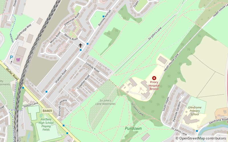
South Purdown, Bristol, is an ancient green space located in north Bristol, England. The area of land is bordered by central Muller Road, Sir Johns Lane Allotment site, Stoke Park, Lockleaze Open Space and the Priory Hospital, and has been designated a Site of Nature Conservation Interest and an important wildlife corridor. ()
Elevation: 226 ft a.s.l.Coordinates: 51°28'51"N, 2°34'9"W
Address
LockleazeBristol
ContactAdd
Social media
Add
Getting there by public transportation
Public transportation stops near this location
- Bus
- Train
 Bus
Bus
- Calculate routeGlenfrome Road 11 min walk
- Calculate routeStapleton Church 14 min walk
- Calculate routeThe Chine 19 min walk
- Calculate routeStapleton Road 25 min walk
- Calculate routeMontpelier 31 min walk
Day trips


Frequently Asked Questions (FAQ)
Which popular attractions are close to South Purdown?
Nearby attractions include Purdown BT Tower, Bristol (11 min walk), Church of Holy Trinity, Bristol (13 min walk), Purdown, Bristol (13 min walk), New Orphan Houses, Bristol (13 min walk).
How to get to South Purdown by public transport?
The nearest stations to South Purdown:
Bus
Train
Bus
- Glenfrome Road • Lines: Y4 (11 min walk)
- Stapleton Church • Lines: Y4 (14 min walk)
Train
- Stapleton Road (25 min walk)
- Montpelier (31 min walk)