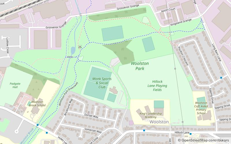
Woolston Park, Warrington
Map
Facts and practical information
Woolston Park is a modern park that is situated in the civil parish of Woolston, Warrington, in the English county of Cheshire. ()
Elevation: 49 ft a.s.l.Coordinates: 53°24'15"N, 2°32'30"W
Getting there by public transportation
Public transportation stops near this location
- Bus
- Train
 Bus
Bus
- Calculate routeMedical Centre 8 min walk
- Calculate routeGreymist Avenue 11 min walk
- Calculate routeHoles Lane 12 min walk
- Calculate routeCliftonville Road 13 min walk
- Calculate routePadgate 17 min walk
- Calculate routeBirchwood 23 min walk
Day trips


Frequently Asked Questions (FAQ)
How to get to Woolston Park by public transport?
The nearest stations to Woolston Park:
Bus
Train
Bus
- Medical Centre • Lines: 4 (8 min walk)
- Greymist Avenue • Lines: 100, 3 (11 min walk)
Train
- Padgate (17 min walk)
- Birchwood (23 min walk)