Pipers Island, Reading
Map

Map

Facts and practical information
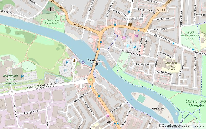
Pipers Island, or Piper's Island, is the third-smallest map-named island in the River Thames, in England. It is on the Reading, Berkshire reach. It is toward the edge of the central urban area of the town of Reading and connected by a gangway to Caversham Bridge, a road and pedestrian bridge that links that town to its left bank suburb of Caversham. ()
Coordinates: 51°27'57"N, 0°58'35"W
Address
CavershamReading
ContactAdd
Social media
Add
Day trips
Pipers Island – popular in the area (distance from the attraction)
Nearby attractions include: Broad Street, Queen Victoria Street, Union Street, Broad Street Mall.
Frequently Asked Questions (FAQ)
Which popular attractions are close to Pipers Island?
Nearby attractions include Caversham Bridge, Reading (1 min walk), Caversham Court, Reading (6 min walk), West Memorial Hall, Reading (7 min walk), St Peter's Church, Reading (7 min walk).
How to get to Pipers Island by public transport?
The nearest stations to Pipers Island:
Train
Bus
Train
- Reading (13 min walk)
- Reading West (25 min walk)
Bus
- RailAir Lounge (15 min walk)
- Reading Station • Lines: 13, 14, 19a, 19b, 19c, 3, 6, Ra1 (16 min walk)


