Merrick, Silver Flowe-Merrick Kells
#2 among attractions in Silver Flowe-Merrick Kells


Facts and practical information
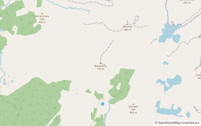
The Merrick, or simply Merrick, is a mountain in the Range of the Awful Hand, a sub-range of the Galloway Hills range, part of the Southern Uplands of Scotland. The summit elevation is 843 metres, making it the highest mountain in the Southern Uplands and southern Scotland. ()
Silver Flowe-Merrick Kells United Kingdom
Merrick – popular in the area (distance from the attraction)
Nearby attractions include: Merrick, Loch Trool, Loch Macaterick, Loch Enoch.
 Nature, Natural attraction, Mountain
Merrick, Silver Flowe-Merrick Kells
33 min walk • The Merrick, or simply Merrick, is a mountain in the Range of the Awful Hand, a sub-range of the Galloway Hills range, part of the Southern Uplands of Scotland.
 Nature, Natural attraction, Lake
Loch Trool
65 min walk • Loch Trool is a narrow, freshwater loch in Galloway, in the Southern Uplands in south-west Scotland. It lies in an elevated position in Glen Trool in the Galloway Forest Park and is approximately 8 miles north of the town of Newton Stewart.
 Nature, Natural attraction, Lake
Loch Macaterick, Silver Flowe-Merrick Kells
125 min walk • Loch Macaterick is a loch in East Ayrshire, Scotland within Galloway Forest Park and Merrick Kells SSSI. The loch is situated to the north of Macaterick, to the west of Craigfionn and to the southeast of Loch Riecawr.
 Nature, Natural attraction, Lake
Loch Enoch, Silver Flowe-Merrick Kells
52 min walk • Loch Enoch is a multi-basin freshwater loch in Galloway, to the east of Merrick and south of Mullwharchar. The loch is situated in a granite basin and has several small islands and some beaches on its shore.
 Nature, Natural attraction, Protected area
Round Loch of Glenhead, Silver Flowe-Merrick Kells
79 min walk • The Round Loch of Glenhead is a small upland single basin loch in Dumfries and Galloway. It is situated within Galloway Forest Park to the west of the hill Craiglee. It forms a pair with the nearby Long Loch of Glenhead. Both lochs are of similar sizes and each have a small island.
 Nature, Natural attraction, Lake
Kirriereoch Loch
91 min walk • Kirriereoch Loch is a small, shallow, square shaped, freshwater loch in Dumfries and Galloway, in the Southern Uplands of south-west Scotland. It lies approximately 12 mi north of the town of Newton Stewart.
 Nature, Natural attraction, Mountain
Kirriereoch Hill, Silver Flowe-Merrick Kells
50 min walk • Kirriereoch Hill is a hill in the Range of the Awful Hand, a sub-range of the Galloway Hills range, part of the Southern Uplands of Scotland.
 Nature, Natural attraction, Mountain
Mullwharchar, Silver Flowe-Merrick Kells
75 min walk • Mullwharchar is a hill in the Dungeon Hills, a sub-range of the Galloway Hills range, part of the Southern Uplands of Scotland. Mullwarchar is situated to the north of Loch Enoch, west of Corserine, northeast of Merrick and east of Kirriereoch Hill.
 Nature, Natural attraction, Mountain
Corserine, Silver Flowe-Merrick Kells
140 min walk • Corserine is a hill in the Rhinns of Kells, a sub-range of the Galloway Hills range, part of the Southern Uplands of Scotland. The highest point of the range and the second highest point in Galloway, the usual route of ascent is from the car park at Forrest Lodge to the east of the hill via Loch Harrow and North Gairy Top.
 Nature, Natural attraction, Mountain
Lamachan Hill
113 min walk • Lamachan Hill is a hill in the Minnigaff Hills, a sub-range of the Galloway Hills range, part of the Southern Uplands of Scotland. It is the highest hill of the range, lying 11 kilometres north of the town of Newton Stewart in Dumfries and Galloway.
 Nature, Natural attraction, Mountain
Galloway Hills, Silver Flowe-Merrick Kells
78 min walk • The Galloway Hills are part of the Southern Uplands of Scotland, and form the northern boundary of western Galloway. They lie within the bounds of the Galloway Forest Park, an area of some 300 square miles of largely uninhabited wild land, managed by Forestry and Land Scotland.
