West Craigs, Edinburgh
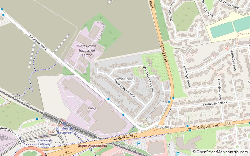
Map
Facts and practical information
West Craigs is the name given to two separate areas of Scotland: ()
Coordinates: 55°56'34"N, 3°18'57"W
Address
West CraigsEdinburgh
ContactAdd
Social media
Add
Getting there by public transportation
Public transportation stops near this location
- Bus
- Tram
- Train
 Bus
Bus
- Calculate routeNorth Gyle Terrace 4 min walk
- Calculate routeMaybury Road 6 min walk
- Calculate routeGyle Centre Bus Terminus 9 min walk
- Calculate routeGyle Centre 9 min walk
- Calculate routeEdinburgh Gateway 6 min walk
- Calculate routeSouth Gyle 20 min walk
- Calculate routeEdinburgh Park 28 min walk
- Calculate routeEdinburgh Gateway 7 min walk
- Calculate routeGyle Centre 9 min walk
- Calculate routeGogarburn 19 min walk
Day trips


Frequently Asked Questions (FAQ)
Which popular attractions are close to West Craigs?
Nearby attractions include Maybury, Edinburgh (5 min walk), Gogarloch, Edinburgh (15 min walk), East Craigs, Edinburgh (17 min walk), South Gyle, Edinburgh (19 min walk).
How to get to West Craigs by public transport?
The nearest stations to West Craigs:
Bus
Train
Tram
Bus
- North Gyle Terrace • Lines: 31 (4 min walk)
- Maybury Road • Lines: 100, 200, 31 (6 min walk)
Train
- Edinburgh Gateway (6 min walk)
- South Gyle (20 min walk)
Tram
- Edinburgh Gateway • Lines: Edinburgh Trams Eastbound, Edinburgh Trams Westbound (7 min walk)
- Gyle Centre • Lines: Edinburgh Trams Eastbound, Edinburgh Trams Westbound (9 min walk)