Silverlink Shopping Park, Newcastle upon Tyne

Gallery (1)
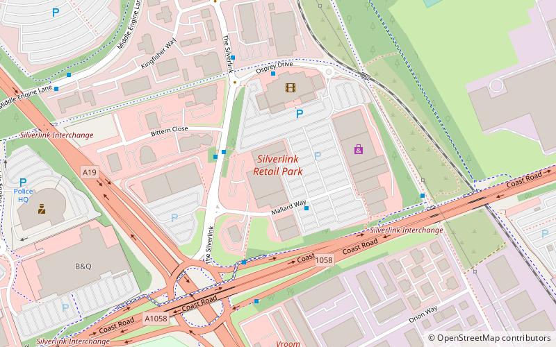
Map
Map
Facts and practical information
The Silverlink Shopping Park is a retail park in North Tyneside, England containing more than 20 stores with retail accommodation of 208,000 square feet. It was developed by the Crown Estate, has 927 car parking spaces, and has an annual footfall of 7.2 million. ()
Coordinates: 55°0'41"N, 1°29'43"W
Address
Newcastle upon Tyne
ContactAdd
Social media
Add
Getting there by public transportation
Public transportation stops near this location
- Bus
- Light rail
- Train
 Bus
Bus
- Calculate routeSilverlink Shopping Park 5 min walk
- Calculate routeMiddle Engine Lane Atmel 8 min walk
- Calculate routeHowdon 28 min walk
- Calculate routePercy Main 30 min walk
- Calculate routeMeadow Well 35 min walk
- Calculate routePercy Main 30 min walk
Day trips


Frequently Asked Questions (FAQ)
Which popular attractions are close to Silverlink Shopping Park?
Nearby attractions include Stephenson Railway Museum, Newcastle upon Tyne (10 min walk), North Tyneside Steam Railway, Newcastle upon Tyne (12 min walk).
How to get to Silverlink Shopping Park by public transport?
The nearest stations to Silverlink Shopping Park:
Bus
Light rail
Train
Bus
- Silverlink Shopping Park • Lines: 306, 308 (5 min walk)
- Middle Engine Lane Atmel • Lines: 309, 310, X39 (8 min walk)
Light rail
- Howdon • Lines: Yellow (28 min walk)
- Percy Main • Lines: Yellow (30 min walk)
Train
- Percy Main (30 min walk)