Lavender Pond, London
Map

Map

Facts and practical information
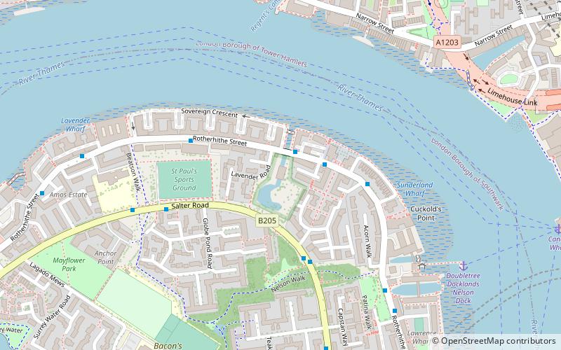
Lavender Pond is a 2.5 acre local nature reserve in Rotherhithe in the London Borough of Southwark. It is owned by Southwark Council and managed by The Conservation Volunteers. The nature reserve has an area of woodland as well as the pond. ()
Elevation: 16 ft a.s.l.Coordinates: 51°30'22"N, 0°2'14"W
Address
Southwark (Rotherhithe)London
ContactAdd
Social media
Add
Day trips
Lavender Pond – popular in the area (distance from the attraction)
Nearby attractions include: One Canada Square, Limehouse Basin, The Grapes, King Edward Memorial Park.
Frequently Asked Questions (FAQ)
Which popular attractions are close to Lavender Pond?
Nearby attractions include Regent's Canal, London (6 min walk), Limehouse Basin Lock, London (7 min walk), Limehouse Basin, London (9 min walk), Canary Wharf Pier, London (10 min walk).
How to get to Lavender Pond by public transport?
The nearest stations to Lavender Pond:
Ferry
Light rail
Bus
Train
Metro
Ferry
- Doubletree Docklands Nelson Dock • Lines: Rb4 (7 min walk)
- Canary Wharf • Lines: Rb1, Rb1X, Rb4, Rb6 (10 min walk)
Light rail
- Limehouse Platform 3 • Lines: B-L, B-Wa, Tg-B (11 min walk)
- Westferry Platform 1 • Lines: B-L, B-Wa, Tg-B (14 min walk)
Bus
- Westferry Circus / Canary Wharf Pier • Lines: 277, N277 (12 min walk)
- Salter Street • Lines: 277, N277 (14 min walk)
Train
- Limehouse (12 min walk)
- Rotherhithe (19 min walk)
Metro
- Canada Water • Lines: Jubilee (20 min walk)
- Canary Wharf • Lines: Jubilee (22 min walk)

 Tube
Tube


