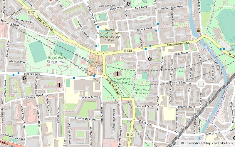
St Dunstan's, London
Map

Map

Facts and practical information
St Dunstan's, Stepney, is an Anglican Church which stands on a site that has been used for Christian worship for over a thousand years. It is located in Stepney High Street, in Stepney, London Borough of Tower Hamlets. ()
Coordinates: 51°31'1"N, 0°2'30"W
Address
Stepney High StreetTower Hamlets (St. Dunstan's and Stepney Green)London
Contact
+44 20 7702 8685
Social media
Add
Day trips
St Dunstan's – popular in the area (distance from the attraction)
Nearby attractions include: Limehouse Basin, The Grapes, King Edward Memorial Park, The Guardian Angels Church.
Frequently Asked Questions (FAQ)
Which popular attractions are close to St Dunstan's?
Nearby attractions include Stepney Green Park, London (6 min walk), Ragged School Museum, London (8 min walk), Arbour Square, London (9 min walk), Salmon Lane Lock, London (9 min walk).
How to get to St Dunstan's by public transport?
The nearest stations to St Dunstan's:
Bus
Train
Light rail
Metro
Ferry
Bus
- Harford Street • Lines: 309 (4 min walk)
- Stepney Green School • Lines: 309 (4 min walk)
Train
- Limehouse (8 min walk)
- Shadwell (20 min walk)
Light rail
- Limehouse Platform 4 • Lines: B-L, B-Wa, Tg-B (9 min walk)
- Shadwell Platform 2 • Lines: B-L, B-Wa, Tg-B (19 min walk)
Metro
- Stepney Green • Lines: District, Hammersmith & City (11 min walk)
- Mile End • Lines: Central, District, Hammersmith & City (18 min walk)
Ferry
- Doubletree Docklands Nelson Dock • Lines: Rb4 (25 min walk)
- Canary Wharf • Lines: Rb1, Rb1X, Rb4, Rb6 (25 min walk)

 Tube
Tube


