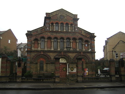
Printworks, London
Map

Map

Facts and practical information
Printworks is a nightclub and events venue in Rotherhithe, South London. It is located in the former Harmsworth Quays printing plant, which printed newspapers including the Daily Mail and Evening Standard until 2012. ()
Coordinates: 51°29'52"N, 0°2'37"W
Day trips
Printworks – popular in the area (distance from the attraction)
Nearby attractions include: Limehouse Basin, Tobacco Dock, The Grapes, The Den.
Frequently Asked Questions (FAQ)
Which popular attractions are close to Printworks?
Nearby attractions include Rotherhithe, London (5 min walk), Stave Hill, London (7 min walk), Surrey Docks Farm, London (12 min walk), Brunel Museum, London (13 min walk).
How to get to Printworks by public transport?
The nearest stations to Printworks:
Metro
Bus
Train
Ferry
Light rail
Metro
- Canada Water • Lines: Jubilee (7 min walk)
- Bermondsey • Lines: Jubilee (23 min walk)
Bus
- Canada Water Bus Station (8 min walk)
- John Silkin Lane • Lines: 225 (16 min walk)
Train
- Surrey Quays (10 min walk)
- Rotherhithe (11 min walk)
Ferry
- Greenland Pier • Lines: Rb1 (14 min walk)
- Doubletree Docklands Nelson Dock • Lines: Rb4 (18 min walk)
Light rail
- Heron Quays Platform 1 • Lines: B-L, S-L (26 min walk)
- Limehouse Platform 4 • Lines: B-L, B-Wa, Tg-B (26 min walk)

 Tube
Tube


