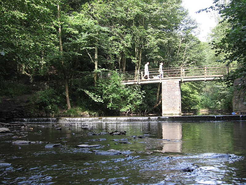
Frome Valley Walkway, Bristol

Gallery (2)
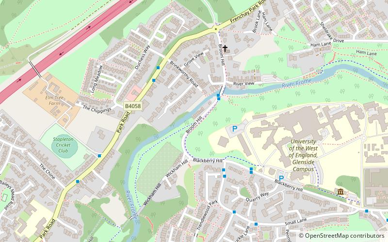
Map
Map
Gallery
Facts and practical information
The Frome Valley Walkway is an 18-mile footpath which follows the River Frome from the River Avon in the centre of Bristol to the Cotswold Hills in South Gloucestershire. The path also links the Cotswold Way National Trail at one end with the Avon Walkway at the other. ()
Coordinates: 51°29'6"N, 2°32'53"W
Address
EastvilleBristol
ContactAdd
Social media
Add
Getting there by public transportation
Public transportation stops near this location
- Bus
 Bus
Bus
- Calculate routeBrinkworthy Road 3 min walk
- Calculate routeThe Chine 6 min walk
- Calculate routeSheldrake Drive 9 min walk
- Calculate routeStapleton Church 12 min walk
Day trips


Frequently Asked Questions (FAQ)
Which popular attractions are close to Frome Valley Walkway?
Nearby attractions include Glenside Museum, Bristol (6 min walk), Snuff Mills, Bristol (9 min walk), Stapleton, Bristol (11 min walk), Stoke Park, Bristol (12 min walk).
How to get to Frome Valley Walkway by public transport?
The nearest stations to Frome Valley Walkway:
Bus
Bus
- Brinkworthy Road • Lines: Y4 (3 min walk)
- The Chine • Lines: Y4 (6 min walk)