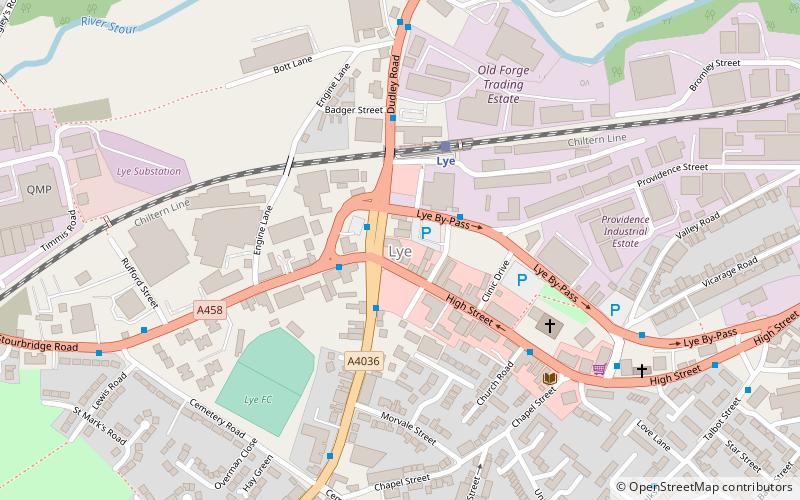
Lye, Stourbridge
Map
Facts and practical information
Lye or The Lye is an area in the Dudley Metropolitan Borough, in the West Midlands county, England, 1.75 miles east of Stourbridgeand borders with Pedmore and Wollescote. ()
Coordinates: 52°27'31"N, 2°7'1"W
Address
Dudley (Lye and Stourbridge North)Stourbridge
ContactAdd
Social media
Add
Getting there by public transportation
Public transportation stops near this location
- Bus
- Train
 Bus
Bus
- Calculate routePedmore Rd / High St 2 min walk
- Calculate routeLye By-Pass / Providence St 2 min walk
- Calculate routeHigh St / Lye Church 4 min walk
- Calculate routeVicarage Rd / Vicarage Rd South 6 min walk
- Calculate routeLye 3 min walk
- Calculate routeStourbridge Junction 27 min walk
- Calculate routeStourbridge Town 28 min walk
- Calculate routeCradley Heath 35 min walk
Day trips


Frequently Asked Questions (FAQ)
Which popular attractions are close to Lye?
Nearby attractions include Lye and Wollescote Cemetery, Stourbridge (10 min walk), Stambermill Viaduct, Dudley (19 min walk).
How to get to Lye by public transport?
The nearest stations to Lye:
Bus
Train
Bus
- Pedmore Rd / High St • Lines: 299 (2 min walk)
- Lye By-Pass / Providence St • Lines: 298 (2 min walk)
Train
- Lye (3 min walk)
- Stourbridge Junction (27 min walk)