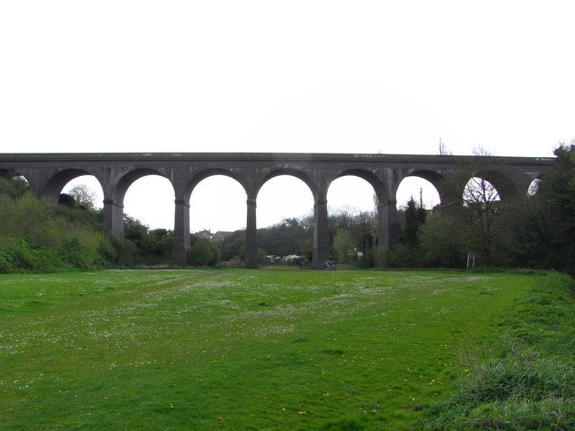
Stambermill Viaduct, Dudley

Gallery (2)
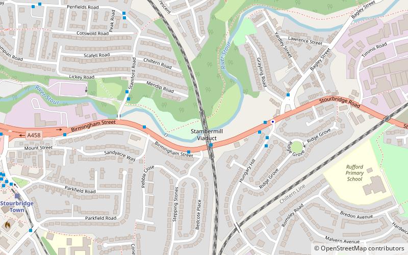
Map
Map
Gallery
Facts and practical information
Stambermill Viaduct is a viaduct situated in Stourbridge, West Midlands, England. It was constructed in 1850 to carry the Oxford Worcester and Wolverhampton Railway across the River Stour, and it carried passenger trains until 1964. It is still in use for goods trains, as the railway continues on to the Round Oak Steel Terminal at Brierley Hill. Freight trains can still be seen passing over the viaduct. ()
Coordinates: 52°27'27"N, 2°8'3"W
Address
Dudley (Lye and Stourbridge North)Dudley
ContactAdd
Social media
Add
Getting there by public transportation
Public transportation stops near this location
- Bus
- Train
 Bus
Bus
- Calculate routeBirmingham St / Stepping Stones 1 min walk
- Calculate routeHungary Hill / Stourbridge Rd 3 min walk
- Calculate routeStamford Rd / Birmingham St 4 min walk
- Calculate routeStourbridge Town 9 min walk
- Calculate routeStourbridge Junction 18 min walk
- Calculate routeLye 20 min walk
Day trips


Frequently Asked Questions (FAQ)
Which popular attractions are close to Stambermill Viaduct?
Nearby attractions include St Thomas' Church, Stourbridge (15 min walk), Stourbridge Library, Stourbridge (15 min walk), Lye, Stourbridge (19 min walk), Lye and Wollescote Cemetery, Stourbridge (22 min walk).
How to get to Stambermill Viaduct by public transport?
The nearest stations to Stambermill Viaduct:
Bus
Train
Bus
- Birmingham St / Stepping Stones • Lines: 298, 299 (1 min walk)
- Hungary Hill / Stourbridge Rd • Lines: 28, 298, 299 (3 min walk)
Train
- Stourbridge Town (9 min walk)
- Stourbridge Junction (18 min walk)