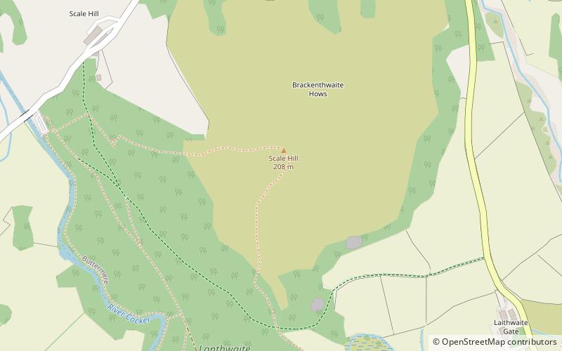
Brackenthwaite Hows, Cockermouth
#6 among attractions in Cockermouth

Facts and practical information
Brackenthwaite Hows is a hill in the Lake District of North West England. ()
Cockermouth United Kingdom
Cockermouth plan & book
Unleash the traveler in you — discover the cheapest flight deals, find the perfect hotel or hostel nearby, and search for the best car rental prices. Travel at your own pace to discover new places and enjoy your journey.
Brackenthwaite Hows – popular in the area (distance from the attraction)
Nearby attractions include: Crummock Water, Scale Force, Loweswater, Whiteless Pike.
 Nature, Natural attraction, Lake
Crummock Water
40 min walk • Crummock Water is a lake in the Lake District in Cumbria, North West England situated between Buttermere to the south and Loweswater to the north. Crummock Water is 2.5 miles long, 0.6 miles wide and 140 feet deep. The River Cocker is considered to start at the north of the lake, before then flowing into Lorton Vale.
 Natural attraction, Nature and wildlife, Park
Scale Force, Lake District National Park
68 min walk • Scale Force is considered the highest waterfall in the English Lake District. Opinions vary about how its precise height is calculated, but the total height is normally stated as 170 feet. It lies on the stream Scale Beck.
 Nature, Natural attraction, Lake
Loweswater
47 min walk • Loweswater is one of the smaller lakes in the English Lake District. The village of Loweswater is situated to the east of the lake.
 Nature, Natural attraction, Cliff
Whiteless Pike
57 min walk • Whiteless Pike is a fell in the north-western English Lake District. It stands immediately east of Crummock Water and forms a pyramid shape when viewed from Rannerdale.
 Nature, Natural attraction, Cliff
Crag Hill
59 min walk • Crag Hill is a mountain in the North Western part of the English Lake District. It was formerly known as Eel Crag; however, the Ordnance Survey now marks Eel Crag as referring to the northern crags of the fell.
 Nature, Natural attraction, Hill
Rannerdale Knotts
54 min walk • Rannerdale Knotts is a fell in the Lake District of Cumbria, England. Rising from the Buttermere valley, it is one of the smaller Cumbrian hills and is overlooked by a number of surrounding fells, such as Grasmoor, Whiteless Pike and, across Crummock Water, Mellbreak and the High Stile ridge.
 Nature, Natural attraction, Hill
Grisedale Pike
74 min walk • Grisedale Pike is a fell in the Lake District, Cumbria, England, situated 4.5 miles west of the town of Keswick in the north-western sector of the national park.
 Nature, Natural attraction, Hill
Hopegill Head
53 min walk • Hopegill Head is a fell in the English Lake District in Cumbria. It is located nine kilometres west of the town of Keswick and is well seen from the B5292 road which crosses the Whinlatter Pass.
 Nature, Natural attraction, Hill
Grasmoor
38 min walk • Grasmoor is a mountain in the north-western part of the Lake District, northern England. It is the highest peak in a group of hills between the villages of Lorton, Braithwaite and Buttermere, and overlooks Crummock Water.
 Nature, Natural attraction, Hill
Sail
73 min walk • Sail is a hill in the English Lake District, lying between Derwentwater and Crummock Water.
 Nature, Natural attraction, Hill
Knott Rigg, Lake District National Park
80 min walk • Knott Rigg is a fell at the head of the Newlands Valley in the English Lake District. It is situated some 8.5 kilometres south west of Keswick and has a modest height of 556 metres.


