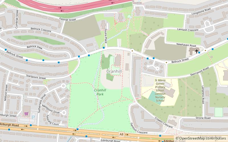
Cranhill, Glasgow
Map
Facts and practical information
Cranhill is an inner city district and housing scheme in the north east of Glasgow, Scotland. Cranhill was developed from public funding in the early 1950s and was originally, chiefly composed of four-storey tenement blocks surrounding a patch of grassland, which became Cranhill Park. Later development saw the building of three tower blocks, surrounded by rows of terraced maisonettes. In more recent years, a number of semi-detached and detached homes have been built. The area also hosts some shops, two primary schools and nurseries, a community centre and the Cranhill water tower. ()
Coordinates: 55°51'54"N, 4°9'57"W
Address
CranhillGlasgow
ContactAdd
Social media
Add
Getting there by public transportation
Public transportation stops near this location
- Bus
- Train
 Bus
Bus
- Calculate routeRuchazie, Gartloch Road/ Elibank Street 13 min walk
- Calculate routeRuchazie, Gartloch Road/ Community centre 14 min walk
- Calculate routeShettleston 22 min walk
- Calculate routeCarntyne 23 min walk
Day trips


Frequently Asked Questions (FAQ)
Which popular attractions are close to Cranhill?
Nearby attractions include Lightburn, Glasgow (11 min walk), Springboig, Glasgow (18 min walk), Craigend, Glasgow (19 min walk), Queenslie, Glasgow (23 min walk).
How to get to Cranhill by public transport?
The nearest stations to Cranhill:
Bus
Train
Bus
- Ruchazie, Gartloch Road/ Elibank Street • Lines: 38, 38A (13 min walk)
- Ruchazie, Gartloch Road/ Community centre • Lines: 38 (14 min walk)
Train
- Shettleston (22 min walk)
- Carntyne (23 min walk)