Pype Hayes Park, Birmingham
Map
Facts and practical information
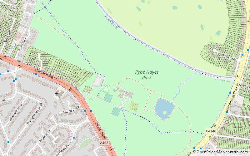
Pype Hayes Park is one of the larger parks in Birmingham, England. The park is in Erdington Constituency and straddles the boundary between Pype Hayes and Erdington (now Tyburn ward. It covers B72 and B24. The northern boundary of the park is the traditional boundary between Erdington and Sutton Coldfield. Pype Hayes Park reaches from the corner where Eachelhurst Road joins Chester Road to a point close to Park Close off Chester Road and in places borders Pitts Farm estate. It also leads to Berwood Farm Road and Welwyndale Road. ()
Elevation: 341 ft a.s.l.Coordinates: 52°31'40"N, 1°48'30"W
Getting there by public transportation
Public transportation stops near this location
- Bus
- Train
 Bus
Bus
- Calculate routeChester Rd / Pype Hayes Park 4 min walk
- Calculate routeEachelhurst Rd / Hansons Bridge Rd 8 min walk
- Calculate routeChester Road 30 min walk
Day trips


Frequently Asked Questions (FAQ)
Which popular attractions are close to Pype Hayes Park?
Nearby attractions include Plantsbrook Local Nature Reserve, Birmingham (15 min walk), Birmingham and Fazeley Canal, Birmingham (17 min walk), Orphanage Road, Birmingham (21 min walk).
How to get to Pype Hayes Park by public transport?
The nearest stations to Pype Hayes Park:
Bus
Train
Bus
- Chester Rd / Pype Hayes Park • Lines: 28 (4 min walk)
- Eachelhurst Rd / Hansons Bridge Rd • Lines: X14 (8 min walk)
Train
- Chester Road (30 min walk)