Harrisburg Subdivision, Philadelphia
Map
Facts and practical information
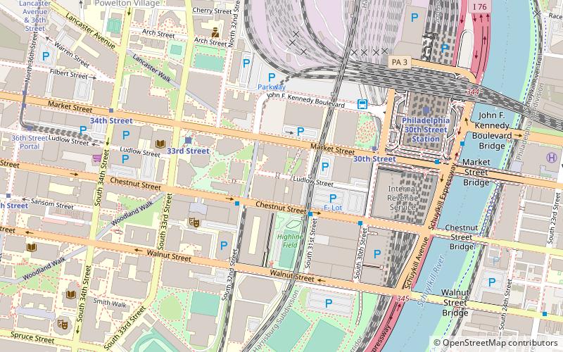
The Harrisburg Subdivision is a railroad line owned by CSX Transportation in the U.S. state of Pennsylvania. The line is located in the city of Philadelphia, connecting Greenwich Yard and the Philadelphia Subdivision with the Trenton Subdivision along a former Pennsylvania Railroad line. Much of the Harrisburg Subdivision is the High Line or West Philadelphia Elevated along 31st Street over the 30th Street Station area. ()
Coordinates: 39°57'16"N, 75°11'11"W
Address
West Philadelphia (University City)Philadelphia
ContactAdd
Social media
Add
Getting there by public transportation
Public transportation stops near this location
- Metro
- Bus
- Tram
- Train
 Metro
Metro
- Calculate route30th Street 4 min walk
- Calculate route34th Street 8 min walk
- Calculate route40th Street 22 min walk
- Calculate route15th Street 28 min walk
- Calculate route30th Street 4 min walk
- Calculate route33rd Street 5 min walk
- Calculate route36th Street Portal 11 min walk
- Calculate routeMegabus 5 min walk
- Calculate routeBolt Bus 5 min walk
- Calculate routeWalnut St & 23rd St 13 min walk
- Calculate routePhiladelphia 30th Street Station 7 min walk
- Calculate routePenn Medicine 13 min walk
- Calculate routeSuburban Station 26 min walk
Maps SEPTA Regional Rail
SEPTA Regional RailDay trips


Frequently Asked Questions (FAQ)
Which popular attractions are close to Harrisburg Subdivision?
Nearby attractions include Campus of Drexel University, Philadelphia (2 min walk), Centennial National Bank, Philadelphia (2 min walk), Pennsylvania Railroad Office Building, Philadelphia (4 min walk), Walnut Street, Philadelphia (5 min walk).
How to get to Harrisburg Subdivision by public transport?
The nearest stations to Harrisburg Subdivision:
Metro
Tram
Bus
Train
Metro
- 30th Street • Lines: Mfl (4 min walk)
- 34th Street • Lines: Mfl (8 min walk)
Tram
- 30th Street • Lines: 10, 11, 13, 34, 36 (4 min walk)
- 33rd Street • Lines: 10, 11, 13, 34, 36 (5 min walk)
Bus
- Megabus (5 min walk)
- Bolt Bus (5 min walk)
Train
- Philadelphia 30th Street Station (7 min walk)
- Penn Medicine (13 min walk)