Trek Zone

Lenawee Mountain, Arapahoe Basin

#3 among attractions in Arapahoe Basin

Nature, Natural attraction, Mountain
Lenawee Mountain location map
Map

Facts and practical information
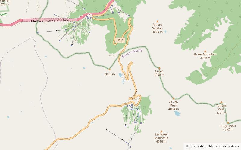
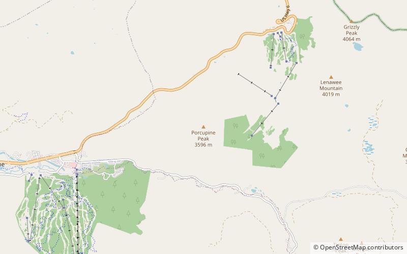
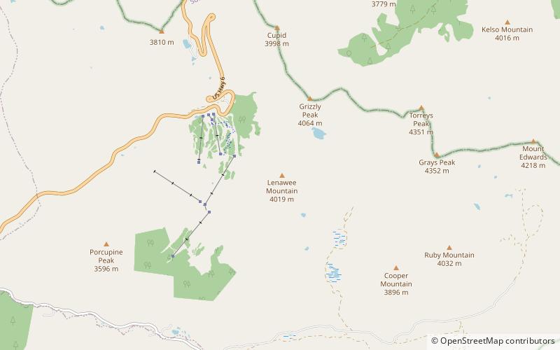
Elevation: 13186 ftCoordinates: 39°37'48"N, 105°51'22"W
Address

Arapahoe Basin United States

ContactAdd
Social media
Add
Day trips

Lenawee Mountain – popular in the area (distance from the attraction)

Nearby attractions include: Loveland Ski Area, Grays Peak, Pass Lake, Torreys Peak.

  • loveland ski area arapaho national forest4.1 miNW
  • grays peak arapaho national forest2 miE
  • pass lake arapahoe basin location map
    2.1 miNW
  • torreys peak arapaho national forest2.1 miNE
  • american discovery trail arapaho national forest location map
    3.9 miE
  • grizzly peak arapaho national forest1.1 miN
  • mount sniktau arapaho national forest3.3 miN
  • grays peak trail arapaho national forest2.5 miE
  • clear creek arapaho national forest4.7 miNW
  • mount edwards arapaho national forest3.3 miE
  • porcupine peak arapahoe basin location map
    2.4 miW

Where to next? Visit colorado Colorado region page or discover the top tourist attractions in United States.