Bayside Cemetery, New York City

Map
Facts and practical information
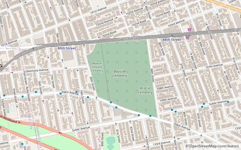
Bayside Cemetery is a Jewish cemetery at 80-35 Pitkin Avenue in Ozone Park, Queens, New York City. It covers about 12 acres and has about 35,000 interments. It is bordered on the east by Acacia Cemetery, on the north by Liberty Avenue, on the west by Mokom Sholom Cemetery, and on the south by Pitkin Avenue. ()
Coordinates: 40°40'40"N, 73°51'19"W
Address
Southwestern Queens (Ozone Park)New York City
ContactAdd
Social media
Add
Day trips
Bayside Cemetery – popular in the area (distance from the attraction)
Nearby attractions include: Cypress Hills Cemetery, Andrews United Methodist Church, Neir's Tavern, Conduit Avenue.
Frequently Asked Questions (FAQ)
How to get to Bayside Cemetery by public transport?
The nearest stations to Bayside Cemetery:
Bus
Metro
Bus
- Pitkin Avenue & Sutter Avenue • Lines: Q7 (5 min walk)
- Euclid Avenue & Linden Boulevard • Lines: B13 (26 min walk)
Metro
- 80th Street • Lines: A (6 min walk)
- 88th Street • Lines: A (7 min walk)
 Subway
 Manhattan Buses


